
IMAGES TAKEN NEAR TO
Reigate Road, BETCHWORTH, RH3 7EY
Introduction
This page details the photographs taken nearby to Reigate Road, RH3 7EY by members of the Geograph project.
The Geograph project started in 2005 with the aim of publishing, organising and preserving representative images for every square kilometre of Great Britain, Ireland and the Isle of Man.

There are currently over 7.5m images from over14,400 individuals and you can help contribute to the project by visiting https://www.geograph.org.uk
Image Map
Images are licensed for reuse under creativecommons.org/licenses/by-sa/2.0
Notes
- Clicking on the map will re-center to the selected point.
- The higher the marker number, the further away the image location is from the centre of the postcode.
Image Listing (43 Images Found)
Images are licensed for reuse under creativecommons.org/licenses/by-sa/2.0
Image
Details
Distance
2
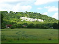
Wheat field at the foot of the North Downs
View north from Brockham Big Field. The quarry cliff is in the next gridsquare to the north.
Image: © Jonathan Billinger
Taken: 19 Jun 2008
0.08 miles
3
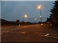
Brockham Lane at the junction of Reigate Road
The North Downs rise on the right
Image: © David Howard
Taken: 20 Nov 2016
0.09 miles
4
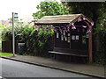
Brockham Bus Bunting
Union flags festoon a bus shelter on Brockham Lane to mark the Queen's Diamond Jubilee.
Image: © Colin Smith
Taken: 29 Jun 2012
0.09 miles
5
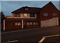
Newly extended house on Brockham Lane
The pointed red brick part is new and the front part is being renovated next.
Image: © David Howard
Taken: 20 Nov 2016
0.10 miles
6
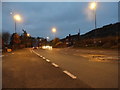
Reigate Road, Brockham
At the junction of Brockham Lane. The North Downs are on the right.
Image: © David Howard
Taken: 20 Nov 2016
0.10 miles
7
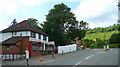
The Postillion Restaurant
Situated on the junction of Brockham Lane with the A25 Dorking to Reigate road.
The North Downs rise up behind the scene.
Image: © Jonathan Billinger
Taken: 19 Jun 2008
0.11 miles
9
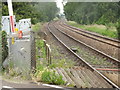
Railway by Cottage Farm
View from a level crossing at Brockham, looking westwards towards Dorking.
Image: © Colin Smith
Taken: 29 Jun 2012
0.12 miles
10
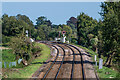
North Downs Line
Looking east along the Redhill - Guildford North Downs Line north of Brockham. The level crossing in the background carries Chalkpit Lane, the access road to the former Brockham Quarry, over the railway.
Image: © Ian Capper
Taken: 13 Sep 2020
0.13 miles