IMAGES TAKEN NEAR TO
London Road, REIGATE, RH2 9QP

Introduction

This page details the photographs taken nearby to London Road, RH2 9QP by members of the Geograph project.

The Geograph project started in 2005 with the aim of publishing, organising and preserving representative images for every square kilometre of Great Britain, Ireland and the Isle of Man.

There are currently over 7.5m images from over14,400 individuals and you can help contribute to the project by visiting https://www.geograph.org.uk

Image Map


Images are licensed for reuse under creativecommons.org/licenses/by-sa/2.0
Notes
  • Clicking on the map will re-center to the selected point.
  • The higher the marker number, the further away the image location is from the centre of the postcode.

Image Listing (519 Images Found)

Images are licensed for reuse under creativecommons.org/licenses/by-sa/2.0
  • ...
Image
Details
Distance
1
London Road
This stretch of road is now almost wholly developed with offices. The building on the right is Douglas House, occupied by Kimberly-Clark. In the background can be seen the level crossing by Reigate Station, with the Reigate Hill TV transmitter on the skyline on the far left of the photo.
Image: © Ian Capper Taken: 19 Jul 2008
0.01 miles
2
London Road, Reigate
Image: © Stacey Harris Taken: 17 May 2009
0.02 miles
3
Douglas House and Foundation House
The rear of offices in London Road, built in the c.1980s on the site of the former goods yard alongside Reigate Station. Seen here from Douglas Road. Douglas House houses the headquarters for the European, Middle East and Asian business of the multi-national Kimberly-Clark.
Image: © Ian Capper Taken: 18 Apr 2022
0.02 miles
4
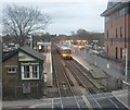
Reigate station
A headlong view of Reigate station from a footbridge above the line.
Image: © Ed of the South Taken: 31 Mar 2012
0.02 miles
5
Homebase
DIY shed built in the 1980s on the site of the former goods yard alongside Reigate Station.
Image: © Ian Capper Taken: 1 Apr 2012
0.02 miles
6
A217
Image: © N Chadwick Taken: 28 Dec 2021
0.02 miles
7
Rushworth Rd
Image: © N Chadwick Taken: 12 Apr 2019
0.02 miles
8
45 London Road
Modern office block on London Road at its junction with Yorke Road. Beyond to its right is Fonteyn House (see Image).
Image: © Ian Capper Taken: 27 Nov 2011
0.03 miles
9
28 London Road
Early/mid 19th century villa, called Sunningdale. Grade II listed - for listing particulars see www.historicengland.org.uk/listing/the-list/list-entry/1377970. Beyond is 26 London Road, also grade II listed - see Image
Image: © Ian Capper Taken: 9 May 2009
0.03 miles
10
London Road
On the left is Fonteyn House (see Image). Beyond is the level crossing where the Redhill-Guildford railway crosses the A217. In the background is Reigate Hill, with its TV mast on the skyline.
Image: © Ian Capper Taken: 27 Nov 2011
0.03 miles
  • ...