IMAGES TAKEN NEAR TO
Tilers Way, REIGATE, RH2 7PW
Introduction
This page details the photographs taken nearby to Tilers Way, RH2 7PW by members of the Geograph project.
The Geograph project started in 2005 with the aim of publishing, organising and preserving representative images for every square kilometre of Great Britain, Ireland and the Isle of Man.

There are currently over 7.5m images from over14,400 individuals and you can help contribute to the project by visiting https://www.geograph.org.uk
Image Map
Images are licensed for reuse under creativecommons.org/licenses/by-sa/2.0
Notes
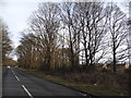
- Clicking on the map will re-center to the selected point.
- The higher the marker number, the further away the image location is from the centre of the postcode.
Image Listing (16 Images Found)
Images are licensed for reuse under creativecommons.org/licenses/by-sa/2.0
Image
Details
Distance
2
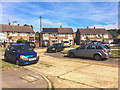
Felland Way
1950s housing in Felland Way.
Image: © Ian Capper
Taken: 4 Aug 2018
0.14 miles
3
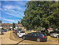
Felland Way
1950s housing in Felland Way.
Image: © Ian Capper
Taken: 4 Aug 2018
0.14 miles
5
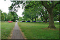
Path across part of Earlswood Common
Small parts of the common are north of Pendleton Road, as here. The parked cars are on Yeats Close.
Image: © Robin Webster
Taken: 14 Jul 2010
0.18 miles
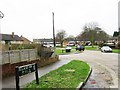
6
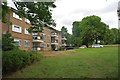
Flats facing Earlswood Common
Accessed from Yeats Close, the road ahead.
Image: © Robin Webster
Taken: 14 Jul 2010
0.20 miles
7
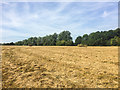
Behind Felland Way
Area of grassland behind Felland Way.
Image: © Ian Capper
Taken: 4 Aug 2018
0.21 miles
8
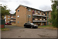
Mackrells
A block of flats deriving its name from a former farm in this area.
Image: © Robin Webster
Taken: 14 Jul 2010
0.22 miles
9
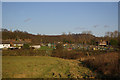
New Pond Farm Allotments
Allotments on the edge of Woodhatch, viewed from the local authority open space which lies between Lonesome Lane and the A2044 Woodhatch Road alongside Earlswood Brook. In the background on the left can be seen the steeple of St John's Church (see Image).
Image: © Ian Capper
Taken: 18 Jan 2009
0.22 miles
10
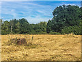
Behind Felland Way
Area of grassland behind Felland Way.
Image: © Ian Capper
Taken: 4 Aug 2018
0.22 miles