IMAGES TAKEN NEAR TO
Frenches, PULBOROUGH, RH20 4NR

Introduction

This page details the photographs taken nearby to Frenches, RH20 4NR by members of the Geograph project.

The Geograph project started in 2005 with the aim of publishing, organising and preserving representative images for every square kilometre of Great Britain, Ireland and the Isle of Man.

There are currently over 7.5m images from over14,400 individuals and you can help contribute to the project by visiting https://www.geograph.org.uk

Image Map


Images are licensed for reuse under creativecommons.org/licenses/by-sa/2.0
Notes
  • Clicking on the map will re-center to the selected point.
  • The higher the marker number, the further away the image location is from the centre of the postcode.

Image Listing (8 Images Found)

Images are licensed for reuse under creativecommons.org/licenses/by-sa/2.0
Image
Details
Distance
1
Oops! I am home.
An unusual house name plate.
Image: © Peter Jeffery Taken: Unknown
0.06 miles
2
Houses on Old Mill Drive, Storrington
Image: © David Howard archives Taken: Unknown
0.22 miles
3
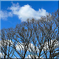
Bare trees, blue sky and clouds
Image: © Ian Hawfinch Taken: 7 Apr 2023
0.22 miles
4
Pond in Storrington
Image: © Josie Campbell Taken: 7 May 2012
0.23 miles
5
Arun District : Storrington & West Chiltington Common
Looking down on the two towns and countryside of West Sussex.
Image: © Lewis Clarke Taken: 23 Aug 2012
0.23 miles
6
Windmill Copse, Storrington
Narrowly escaping various building proposals, the remainder of this small copse is now amenity woodland and seems to be referred to as The Glade, which is also the name of one of the residential roads built on the rest of the original wood.
Image: © Robin Webster Taken: 23 Jun 2011
0.24 miles
7
Former mill pond, Storrington
Image: © David Martin Taken: 19 Apr 2019
0.24 miles
8
Houses on Old Mill Drive, Storrington
Image: © David Howard archives Taken: Unknown
0.24 miles