IMAGES TAKEN NEAR TO
Fox Court, PULBOROUGH, RH20 4JL
Introduction
This page details the photographs taken nearby to Fox Court, RH20 4JL by members of the Geograph project.
The Geograph project started in 2005 with the aim of publishing, organising and preserving representative images for every square kilometre of Great Britain, Ireland and the Isle of Man.

There are currently over 7.5m images from over14,400 individuals and you can help contribute to the project by visiting https://www.geograph.org.uk
Image Map
Images are licensed for reuse under creativecommons.org/licenses/by-sa/2.0
Notes
- Clicking on the map will re-center to the selected point.
- The higher the marker number, the further away the image location is from the centre of the postcode.
Image Listing (20 Images Found)
Images are licensed for reuse under creativecommons.org/licenses/by-sa/2.0
Image
Details
Distance
1
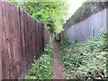
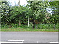
Fences with vegetation
Public footpath 2972 to Cootham.
Image: © Peter Holmes
Taken: 12 May 2015
0.04 miles
2
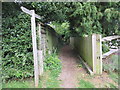
Fingerpost with holly
Public footpath 2972 to Amberley Road (B2139).
Image: © Peter Holmes
Taken: 12 May 2015
0.05 miles
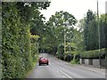
3
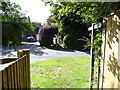
Twitten crosses New Town Road
The fence on the right has been recently erected - see http://www.geograph.org.uk/photo/4516040 for a view the other way taken three months earlier.
Image: © Shazz
Taken: 28 Aug 2015
0.07 miles
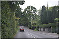
5
Footpath to Kithurst Lane
Public footpath 2661 from Amberley Road (B2139).
Image: © Peter Holmes
Taken: 12 May 2015
0.08 miles
7
The tail that wags the dog
Public footpath 2972 to Cootham.
Image: © Peter Holmes
Taken: 12 May 2015
0.09 miles
9
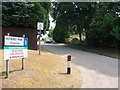
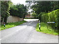
Kithurst Park Get Off My Land
As the signs make very clear this is a very private road and non residents are excluded. All it needs are some really big gates and a guard watch tower or two.
Image: © Nigel Mykura
Taken: 22 Jul 2013
0.12 miles
10
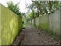
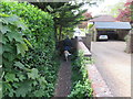
The Plantation, bridleway through residential Storrington
The gap in the left hand fencing is a pathway to Plantation Way.
Image: © Dave Spicer
Taken: 2 Apr 2011
0.12 miles