IMAGES TAKEN NEAR TO
Clay Lane, PULBOROUGH, RH20 4HL
Introduction
This page details the photographs taken nearby to Clay Lane, RH20 4HL by members of the Geograph project.
The Geograph project started in 2005 with the aim of publishing, organising and preserving representative images for every square kilometre of Great Britain, Ireland and the Isle of Man.

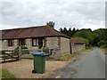
There are currently over 7.5m images from over14,400 individuals and you can help contribute to the project by visiting https://www.geograph.org.uk
Image Map
Images are licensed for reuse under creativecommons.org/licenses/by-sa/2.0
Notes
- Clicking on the map will re-center to the selected point.
- The higher the marker number, the further away the image location is from the centre of the postcode.
Image Listing (18 Images Found)
Images are licensed for reuse under creativecommons.org/licenses/by-sa/2.0
Image
Details
Distance
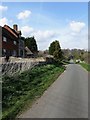
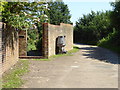
2
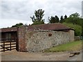
An old, but sturdy wall, Clay Lane, Cootham
Image: © David Smith
Taken: 5 Jul 2015
0.06 miles
3
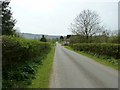
Clay Lane south to the South Downs
Connects the A283 with the B2139, Storrington to Amberley road.
Image: © Dave Spicer
Taken: 2 Apr 2011
0.08 miles
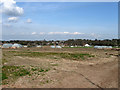
4
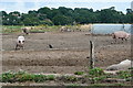
Pigs at Cootham Farm
The pig and the crow seem to be eyeballing each other.
Image: © Graham Horn
Taken: 1 Aug 2010
0.09 miles
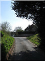
5
Clay Lane
Minor road linking the B2139 Amberley Road with the A283 Pulborough Road. Rod Cottage is on the left whilst Lower Barn is just visible further down the lane.
Image: © Simon Carey
Taken: 5 Apr 2009
0.09 miles
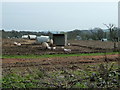
6
Pigs, Cootham Farm
Taken from Clay Lane with the houses of Storrington in the distance.
Image: © Simon Carey
Taken: 5 Apr 2009
0.11 miles
7
Cootham Farmhouse, Clay Lane
The farm buildings are to the rear of the farm house.
Image: © Simon Carey
Taken: 5 Apr 2009
0.12 miles
8
Pigs and piglets opposite Cootham farmhouse
Image: © Dave Spicer
Taken: 2 Apr 2011
0.12 miles
9
Gate and strange carving on footpath
The torso and head are missing! There was rubbish inside.
Image: © Shazz
Taken: 22 Aug 2015
0.13 miles
10
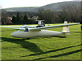
Southdown gliding club
The launch site at this gliding club near to Storrington in West Sussex, facing south east with the South Downs in the background.
Image: © Chris Plunkett
Taken: 23 Jan 2005
0.14 miles