IMAGES TAKEN NEAR TO
Angell Sands, PULBOROUGH, RH20 4FL
Introduction
This page details the photographs taken nearby to Angell Sands, RH20 4FL by members of the Geograph project.
The Geograph project started in 2005 with the aim of publishing, organising and preserving representative images for every square kilometre of Great Britain, Ireland and the Isle of Man.

There are currently over 7.5m images from over14,400 individuals and you can help contribute to the project by visiting https://www.geograph.org.uk
Image Map (Loading...)


Getting Data...Please wait
Leaflet Map data © OpenStreetMap
Images are licensed for reuse under creativecommons.org/licenses/by-sa/2.0
Notes
- Clicking on the map will re-center to the selected point.
- The higher the marker number, the further away the image location is from the centre of the postcode.
Image Listing (13 Images Found)
Images are licensed for reuse under creativecommons.org/licenses/by-sa/2.0
Image
Details
Distance
1
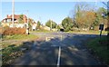
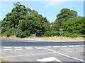
Road junction
Sullington Lane and A283 (Washington Road).
Image: © The Saunterer
Taken: 14 Nov 2012
0.03 miles
2
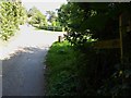
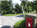
Georgian Post Box
RH20 30 Sullington Lane (Storrington)
Image: © The Saunterer
Taken: 14 Nov 2012
0.05 miles
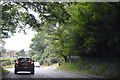
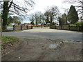
4
Junction of Washington Road and Sullington Lane with post box
A view of the junction from the south is at http://www.geograph.org.uk/photo/3225098.
Image: © Shazz
Taken: 28 Aug 2015
0.05 miles
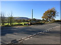
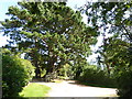
5
The A283 at Sullington Warren
This is the crossroads where Water Lane coming in on the left hand side meets the A283 Washington Rd . The road in the foreground is Sullington Lane
Image: © Nigel Mykura
Taken: 22 Jul 2013
0.07 miles
8
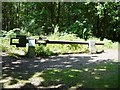
White Mill Windshaft, Sullington Warren
The White Mill was built in about 1800 but was destroyed in a fire in 1933. This cast iron windshaft is all that now remains. It weighs nearly 2 tons and connected the four sails or sweeps to two pairs of millstones via a giant cogwheel.Sullington Warren is woodland owned by the National Trust.
Image: © Janine Forbes
Taken: 16 Jul 2005
0.14 miles
9
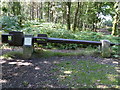
Remains of the White Mill in Sullington Warren
See Image] which is the first geograph for this square.
See also http://www.windmillworld.com/millid/2579.htm although the grid reference here is wrong.
Image: © Shazz
Taken: 28 Aug 2015
0.15 miles