IMAGES TAKEN NEAR TO
Sanders Gate, PULBOROUGH, RH20 3PU
Introduction
This page details the photographs taken nearby to Sanders Gate, RH20 3PU by members of the Geograph project.
The Geograph project started in 2005 with the aim of publishing, organising and preserving representative images for every square kilometre of Great Britain, Ireland and the Isle of Man.

There are currently over 7.5m images from over14,400 individuals and you can help contribute to the project by visiting https://www.geograph.org.uk
Image Map (Loading...)


Getting Data...Please wait
Leaflet Map data © OpenStreetMap
Images are licensed for reuse under creativecommons.org/licenses/by-sa/2.0
Notes
- Clicking on the map will re-center to the selected point.
- The higher the marker number, the further away the image location is from the centre of the postcode.
Image Listing (9 Images Found)
Images are licensed for reuse under creativecommons.org/licenses/by-sa/2.0
Image
Details
Distance
1
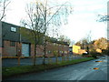
Water Lane Industrial Estate
Looking North West towards factory units
Image: © Chris Shaw
Taken: 4 Dec 2005
0.12 miles
2
Water Lane Industrial Estate
On a quiet Saturday afternoon.
Image: © Dave Spicer
Taken: 2 Apr 2011
0.17 miles
3
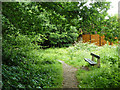
Windmill Copse, Storrington
Narrowly escaping various building proposals, the remainder of this small copse is now amenity woodland and seems to be referred to as The Glade, which is also the name of one of the residential roads built on the rest of the original wood.
Image: © Robin Webster
Taken: 23 Jun 2011
0.21 miles
4
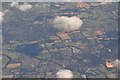
Arun District : Storrington & West Chiltington Common
Looking down on the two towns and countryside of West Sussex.
Image: © Lewis Clarke
Taken: 23 Aug 2012
0.21 miles
5
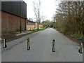
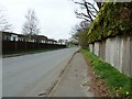
Road barriers on Water Lane Estate
All the Industrial units north from here are owned by the same company so one set of barriers covers all.
Image: © Dave Spicer
Taken: 2 Apr 2011
0.23 miles
7
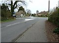
Thatched cottage by mini-roundabout
The name of the cottage is Leather Bottle Cottage.
Image: © Dave Spicer
Taken: 2 Apr 2011
0.24 miles
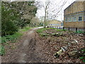
8
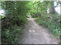
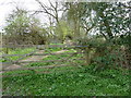
Route to Downsview Avenue
Public Footpath 2448.
Image: © Peter Holmes
Taken: 20 Jul 2013
0.24 miles
9
Northern end of Water Lane Industrial Estate
Image: © Dave Spicer
Taken: 2 Apr 2011
0.24 miles