
IMAGES TAKEN NEAR TO
Viney Close, PULBOROUGH, RH20 3PT
Introduction
This page details the photographs taken nearby to Viney Close, RH20 3PT by members of the Geograph project.
The Geograph project started in 2005 with the aim of publishing, organising and preserving representative images for every square kilometre of Great Britain, Ireland and the Isle of Man.

There are currently over 7.5m images from over14,400 individuals and you can help contribute to the project by visiting https://www.geograph.org.uk
Image Map
Images are licensed for reuse under creativecommons.org/licenses/by-sa/2.0
Notes
- Clicking on the map will re-center to the selected point.
- The higher the marker number, the further away the image location is from the centre of the postcode.
Image Listing (77 Images Found)
Images are licensed for reuse under creativecommons.org/licenses/by-sa/2.0
Image
Details
Distance
1
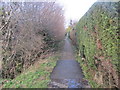
Path adjacent to ditch
Public footpath 2606 to Rectory Lane.
Image: © Peter Holmes
Taken: 8 Feb 2014
0.02 miles
2
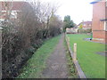
Path behind The Sands
Public footpath 2606 to Rectory Lane.
Image: © Peter Holmes
Taken: 8 Feb 2014
0.05 miles
3
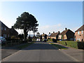
The Sands
A small estate built in the late 1940s on land that once belonged to Sands Farm.
Image: © Simon Carey
Taken: 2 Apr 2013
0.08 miles
4
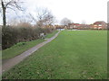
Footpath adjacent to Recreation Ground
Public footpath 2606 to The Sands.
Image: © Peter Holmes
Taken: 8 Feb 2014
0.09 miles
5
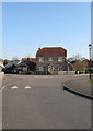
Foster Lane
An estate built on the western edge of Ashington towards the end of the 1990s. Foster Lane meanders from Church Lane to The Sands, here turning east at the junction with Willard Way.
Image: © Simon Carey
Taken: 2 Apr 2013
0.09 miles
6
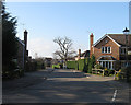
Meiros Way
Built on the site of former fields belonging to neighbouring Meiros Farm which itself has recently been developed, see Image
Image: © Simon Carey
Taken: 2 Apr 2013
0.10 miles
7
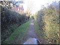
Path between Drain and Hedge
Public footpath 2606 to Rectory Lane.
Image: © Peter Holmes
Taken: 8 Feb 2014
0.10 miles
8
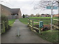
Path to Community Centre
Public footpath 2607.
Image: © Peter Holmes
Taken: 8 Feb 2014
0.11 miles
9
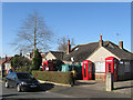
Telephone Box Collection, Hillcrest Drive
Various models of telephone boxes and an old BP petrol pump adorn the front garden of this bungalow in Ashington. Seems to be a popular pastime in the village, see also Image
Image: © Simon Carey
Taken: 31 Mar 2013
0.11 miles
10
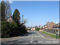
Hillcrest Drive
The northern part of the road was built in the 1950s on the site of an old saw mill, at the junction in the distance it turns south and heads towards Church Lane.
Image: © Simon Carey
Taken: 2 Apr 2013
0.13 miles