IMAGES TAKEN NEAR TO
Goose Green Lane, PULBOROUGH, RH20 2LW
Introduction
This page details the photographs taken nearby to Goose Green Lane, RH20 2LW by members of the Geograph project.
The Geograph project started in 2005 with the aim of publishing, organising and preserving representative images for every square kilometre of Great Britain, Ireland and the Isle of Man.

There are currently over 7.5m images from over14,400 individuals and you can help contribute to the project by visiting https://www.geograph.org.uk
Image Map
Images are licensed for reuse under creativecommons.org/licenses/by-sa/2.0
Notes
- Clicking on the map will re-center to the selected point.
- The higher the marker number, the further away the image location is from the centre of the postcode.
Image Listing (5 Images Found)
Images are licensed for reuse under creativecommons.org/licenses/by-sa/2.0
Image
Details
Distance
1
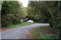
Peacocks Lane
At junction with Billinghurst Road.
Image: © Oast House Archive
Taken: 23 Oct 2018
0.16 miles
2
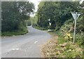
Peacocks Lane
Peacocks Lane viewed from the junction with Goose Green Lane.
Image: © Chris Thomas-Atkin
Taken: 5 Sep 2021
0.17 miles
3
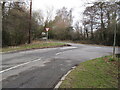
Junction of Peacocks Lane and the B2133
The Brickworks are partially hidden behind the trees
Image: © Dave Spicer
Taken: 11 Feb 2009
0.17 miles
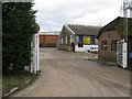
4
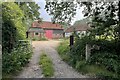
Sir Robert?s Farm
Viewed from Goose Green Lane.
Image: © Chris Thomas-Atkin
Taken: 5 Sep 2021
0.19 miles