IMAGES TAKEN NEAR TO
Gay Street, PULBOROUGH, RH20 2HL
Introduction
This page details the photographs taken nearby to Gay Street, RH20 2HL by members of the Geograph project.
The Geograph project started in 2005 with the aim of publishing, organising and preserving representative images for every square kilometre of Great Britain, Ireland and the Isle of Man.

There are currently over 7.5m images from over14,400 individuals and you can help contribute to the project by visiting https://www.geograph.org.uk
Image Map (Loading...)


Getting Data...Please wait
Leaflet Map data © OpenStreetMap
Images are licensed for reuse under creativecommons.org/licenses/by-sa/2.0
Notes
- Clicking on the map will re-center to the selected point.
- The higher the marker number, the further away the image location is from the centre of the postcode.
Image Listing (23 Images Found)
Images are licensed for reuse under creativecommons.org/licenses/by-sa/2.0
Image
Details
Distance
4
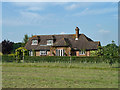
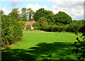
A house called Hayes
On mid 20th century maps this was called Gaywood Lodge, in Victorian times there was nothing here.
Image: © Robin Webster
Taken: 2 Sep 2011
0.06 miles
6
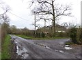
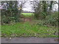
Bridleway junction with Gay Street
The bridleway is called Steepwood Lane.
Image: © Shazz
Taken: 22 Dec 2015
0.07 miles
7
Walnut Tree Cottage, Gay Street
Taken from the bridleway that goes through Woodshill Copse.
Image: © Simon Carey
Taken: 23 Sep 2006
0.08 miles
9
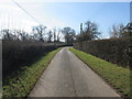
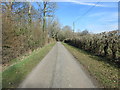
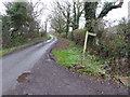
Looking south on Gay Street
Route to Gaywood Farm.
Image: © Peter Holmes
Taken: 7 Mar 2015
0.10 miles
10
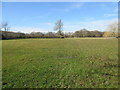
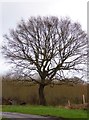
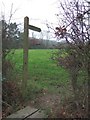
Lone tree by footpath
Public footpath 2320 to Star Farm.
Image: © Peter Holmes
Taken: 7 Mar 2015
0.11 miles