IMAGES TAKEN NEAR TO
Nutbourne Road, PULBOROUGH, RH20 2HA
Introduction
This page details the photographs taken nearby to Nutbourne Road, RH20 2HA by members of the Geograph project.
The Geograph project started in 2005 with the aim of publishing, organising and preserving representative images for every square kilometre of Great Britain, Ireland and the Isle of Man.

There are currently over 7.5m images from over14,400 individuals and you can help contribute to the project by visiting https://www.geograph.org.uk
Image Map
Images are licensed for reuse under creativecommons.org/licenses/by-sa/2.0
Notes
- Clicking on the map will re-center to the selected point.
- The higher the marker number, the further away the image location is from the centre of the postcode.
Image Listing (21 Images Found)
Images are licensed for reuse under creativecommons.org/licenses/by-sa/2.0
Image
Details
Distance
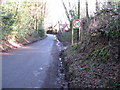
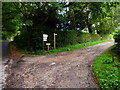
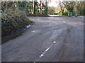
2
Track to Nutbourne Road
Public footpath 2432.
Image: © Peter Holmes
Taken: 3 Aug 2013
0.09 miles
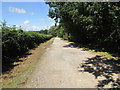
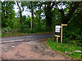
3
Private road to Nutbourne Common
West Sussex Literary Trail on public footpath 2433.
Image: © Peter Holmes
Taken: 3 Aug 2013
0.10 miles
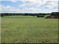
4
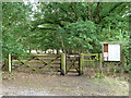
Northern entrance, Nutbourne Common
Pulbourough Parish Council has provided a disproportionately large list of rules and regulations for one of the smaller commons around. There are also warnings of adders. Discouraging visitors or what?
Image: © Robin Webster
Taken: 21 Jun 2011
0.11 miles
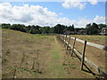
5
Footpath leaves Nutbourne Road at Bramfold Farm
Image: © Shazz
Taken: 25 Oct 2013
0.13 miles
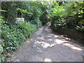
7
Nutbourne Common (1)
Public footpath 2436 to Mill Road.
Image: © Peter Holmes
Taken: 3 Aug 2013
0.16 miles
8
Nutbourne Common (3)
West Sussex Literary Trail on public footpath 2433.
Image: © Peter Holmes
Taken: 3 Aug 2013
0.18 miles
9
Stream Lane junction with Nutbourne Road
Image: © Dave Spicer
Taken: 17 Jan 2010
0.20 miles
10
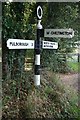
Old Direction Sign - Signpost by Nutborne Road, Pulborough Parish
Annulus finial - 3 arms; WSCC parish halo by the UC road, in parish of Pulborough (Horsham District), junction of Stream Lane with Nutbourne Road.
To be surveyed
Milestone Society National ID: SX_TQ0718
Image: © Milestone Society
Taken: Unknown
0.20 miles