IMAGES TAKEN NEAR TO
West Mare Lane, PULBOROUGH, RH20 2EA
Introduction
This page details the photographs taken nearby to West Mare Lane, RH20 2EA by members of the Geograph project.
The Geograph project started in 2005 with the aim of publishing, organising and preserving representative images for every square kilometre of Great Britain, Ireland and the Isle of Man.

There are currently over 7.5m images from over14,400 individuals and you can help contribute to the project by visiting https://www.geograph.org.uk
Image Map
Images are licensed for reuse under creativecommons.org/licenses/by-sa/2.0
Notes
- Clicking on the map will re-center to the selected point.
- The higher the marker number, the further away the image location is from the centre of the postcode.
Image Listing (17 Images Found)
Images are licensed for reuse under creativecommons.org/licenses/by-sa/2.0
Image
Details
Distance
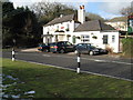
3
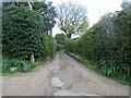
House by Marehill Nurseries
The nurseries are to the right.
Image: © Robin Webster
Taken: 21 Jun 2011
0.10 miles
4
Crossing footpaths seen from the south
See also Image
Image: © Shazz
Taken: 19 Aug 2015
0.14 miles
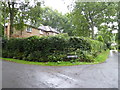
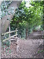
6
West Mare Lane RH20 2EA
Public footpath 2335 at junction with Batts Lane (footpath 2340).
Image: © Peter Holmes
Taken: 23 Apr 2016
0.15 miles
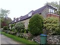
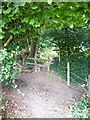
7
Batts Lane, RH20 2ED
Public footpath 2340 to Marsh Farm.
Image: © Peter Holmes
Taken: 23 Apr 2016
0.15 miles
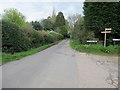
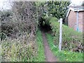
8
Lane to Mare Hill Road (A283)
Public footpath 2335/1.
Image: © Peter Holmes
Taken: 23 Apr 2016
0.18 miles
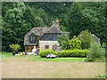
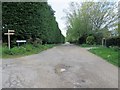
9
Path to Marehill Common
Permissive path owned by Leconfield Estates.
Image: © Peter Holmes
Taken: 23 Apr 2016
0.19 miles