IMAGES TAKEN NEAR TO
The Street, PULBOROUGH, RH20 1PS
Introduction
This page details the photographs taken nearby to The Street, RH20 1PS by members of the Geograph project.
The Geograph project started in 2005 with the aim of publishing, organising and preserving representative images for every square kilometre of Great Britain, Ireland and the Isle of Man.

There are currently over 7.5m images from over14,400 individuals and you can help contribute to the project by visiting https://www.geograph.org.uk
Image Map (Loading...)


Getting Data...Please wait
Leaflet Map data © OpenStreetMap
Images are licensed for reuse under creativecommons.org/licenses/by-sa/2.0
Notes
- Clicking on the map will re-center to the selected point.
- The higher the marker number, the further away the image location is from the centre of the postcode.
Image Listing (73 Images Found)
Images are licensed for reuse under creativecommons.org/licenses/by-sa/2.0
Image
Details
Distance
6
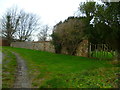
Wall on bridleway in Barlavington
The gate leads into the churchyard.
Image: © Shazz
Taken: 3 Jan 2014
0.08 miles
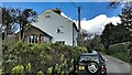
7
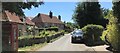
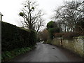
Houses in Sutton
The house behind the main subject is probably in the adjacent grid square (SU9715).
Image: © Ian Hawfinch
Taken: 1 Jun 2020
0.09 miles
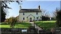
8
Looking south from St John the Baptist, Sutton
Image: © Basher Eyre
Taken: 20 Mar 2010
0.10 miles
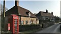
9
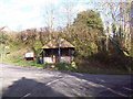
Bus shelter opposite The White Horse, Sutton
Image: © Maigheach-gheal
Taken: 21 Feb 2007
0.10 miles