IMAGES TAKEN NEAR TO
Church Lane, PULBOROUGH, RH20 1PB
Introduction
This page details the photographs taken nearby to Church Lane, RH20 1PB by members of the Geograph project.
The Geograph project started in 2005 with the aim of publishing, organising and preserving representative images for every square kilometre of Great Britain, Ireland and the Isle of Man.

There are currently over 7.5m images from over14,400 individuals and you can help contribute to the project by visiting https://www.geograph.org.uk
Image Map (128 Images)


Getting Data...Please wait
Leaflet Map data © OpenStreetMap
Images are licensed for reuse under creativecommons.org/licenses/by-sa/2.0
Notes
- Clicking on the map will re-center to the selected point.
- The higher the marker number, the further away the image location is from the centre of the postcode.
Image Listing (128 Images Found)
Images are licensed for reuse under creativecommons.org/licenses/by-sa/2.0
Image
Details
Distance
1
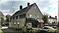
Smiths, Church Lane, Bury
The frontage dates to the 18th century and hides a much older building within.
Image: © Simon Carey
Taken: 28 Dec 2017
0.00 miles
2
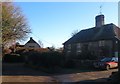
Smiths Barn, Church Lane, Bury
Former farm outbuildings converted into residences about a decade ago.
Image: © Simon Carey
Taken: 28 Dec 2017
0.02 miles
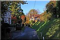
4
Shepherds, Church Lane, Bury
Flint faced house on the lane that heads east to the church and river.
Image: © Simon Carey
Taken: 28 Dec 2017
0.05 miles
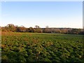
5
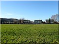
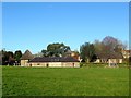
Rowlands
The name of the field according to Bury's 1839 tithe map that is bounded by the buildings of Church Lane to the north, the small Coombe crescent estate to the west and Image to the south.
Image: © Simon Carey
Taken: 28 Dec 2017
0.05 miles
6
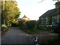
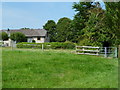
Smiths Cottage, Church Lane
One of a number of cottages in this lane which leads to the church and the river.
Image: © Simon Carey
Taken: 24 Oct 2008
0.06 miles
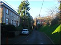
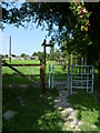
7
Church Lane Bury
The former route from the now defunct ferry across the Arun (looking away from the ferry)
Image: © Glyn Baker
Taken: 18 Nov 2006
0.07 miles
9
Helens Field
The name of the field according to Bury's 1839 tithe map that is located to the north of Church Lane and south of Image
Image: © Simon Carey
Taken: 28 Dec 2017
0.07 miles