IMAGES TAKEN NEAR TO
London Road, PULBOROUGH, RH20 1LR
Introduction
This page details the photographs taken nearby to London Road, RH20 1LR by members of the Geograph project.
The Geograph project started in 2005 with the aim of publishing, organising and preserving representative images for every square kilometre of Great Britain, Ireland and the Isle of Man.

There are currently over 7.5m images from over14,400 individuals and you can help contribute to the project by visiting https://www.geograph.org.uk
Image Map (Loading...)


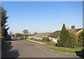
Getting Data...Please wait
Leaflet Map data © OpenStreetMap
Images are licensed for reuse under creativecommons.org/licenses/by-sa/2.0
Notes
- Clicking on the map will re-center to the selected point.
- The higher the marker number, the further away the image location is from the centre of the postcode.
Image Listing (110 Images Found)
Images are licensed for reuse under creativecommons.org/licenses/by-sa/2.0
Image
Details
Distance
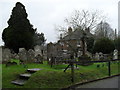
2
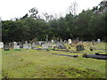
Burial ground opposite St Giles, Coldwaltham
Image: © Basher Eyre
Taken: 20 Mar 2010
0.07 miles
3
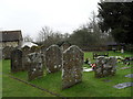
Churchyard of St Giles, Coldwaltham (6)
Image: © Basher Eyre
Taken: 20 Mar 2010
0.07 miles
4
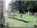
Churchyard of St Giles, Coldwaltham (8)
Image: © Basher Eyre
Taken: 20 Mar 2010
0.07 miles
5
Churchyard of St Giles, Coldwaltham (9)
Image: © Basher Eyre
Taken: 20 Mar 2010
0.07 miles
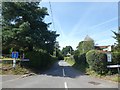
7
Looking down Church Lane towards the main road
Image: © Basher Eyre
Taken: 20 Mar 2010
0.08 miles
8
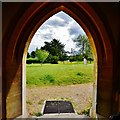
Coldwaltham: St. Giles' church: View from the south entrance porch
Image: © Michael Garlick
Taken: 2 Jul 2015
0.08 miles
9
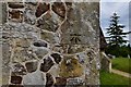
Coldwaltham: St. Giles' church: Benchmark on the west wall
Image: © Michael Garlick
Taken: 2 Jul 2015
0.09 miles
10

Lych Gate, St Giles Church
Leading out onto Church Lane and across to an extension of the graveyard. The occupants of a horse and trap have been framed by the gate.
Image: © Simon Carey
Taken: 5 Apr 2009
0.09 miles