IMAGES TAKEN NEAR TO
London Road, PULBOROUGH, RH20 1LL
Introduction
This page details the photographs taken nearby to London Road, RH20 1LL by members of the Geograph project.
The Geograph project started in 2005 with the aim of publishing, organising and preserving representative images for every square kilometre of Great Britain, Ireland and the Isle of Man.

There are currently over 7.5m images from over14,400 individuals and you can help contribute to the project by visiting https://www.geograph.org.uk
Image Map
Images are licensed for reuse under creativecommons.org/licenses/by-sa/2.0
Notes
- Clicking on the map will re-center to the selected point.
- The higher the marker number, the further away the image location is from the centre of the postcode.
Image Listing (110 Images Found)
Images are licensed for reuse under creativecommons.org/licenses/by-sa/2.0
Image
Details
Distance
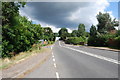
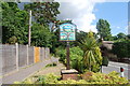
5
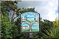
Coldwaltham, Hardham and Watersfield sign on the A29
A closer up version of Image .
Image: © Barry Shimmon
Taken: 11 Aug 2013
0.07 miles
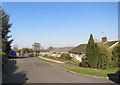
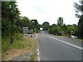
8
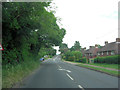
A29 approaches crossroads junction with Brook Lane and Waltham Park Road
Image: © Stuart Logan
Taken: 29 May 2014
0.08 miles
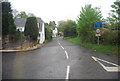
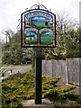
9

Crossroads at the A29 at Coldwaltham
The picture was taken from Brook Lane.
Image: © Shazz
Taken: 3 Apr 2011
0.08 miles