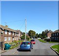
IMAGES TAKEN NEAR TO
Broad Field, EAST GRINSTEAD, RH19 4QR

Introduction

This page details the photographs taken nearby to Broad Field, RH19 4QR by members of the Geograph project.

The Geograph project started in 2005 with the aim of publishing, organising and preserving representative images for every square kilometre of Great Britain, Ireland and the Isle of Man.

There are currently over 7.5m images from over14,400 individuals and you can help contribute to the project by visiting https://www.geograph.org.uk

Image Map


Images are licensed for reuse under creativecommons.org/licenses/by-sa/2.0
Notes
  • Clicking on the map will re-center to the selected point.
  • The higher the marker number, the further away the image location is from the centre of the postcode.

Image Listing (51 Images Found)

Images are licensed for reuse under creativecommons.org/licenses/by-sa/2.0
  • ...
Image
Details
Distance
1
Broadfield, West Hoathly
Small estate off Chapel Row built in the late 1940s and named after the field it was built in.
Image: © Simon Carey Taken: 13 Sep 2020
0.02 miles
2
Footpath behind Broad Field
The path turns right over the stile and runs behind the gardens of houses in Broad Field to reach the main road. It is easier just to walk down Broad Field.
Image: © Robin Webster Taken: 27 Mar 2010
0.06 miles
3
Further Bold Field
The name of the field according to West Hoathly's 1841 tithe map located to the south of Selsfield Road and containing a telecommunications mast. The foliage marks the site of an old pit.
Image: © Simon Carey Taken: 13 Sep 2020
0.06 miles
4
Footpath behind Broadfield
The path runs behind the gardens of houses in Broadfield to reach the main road. It is easier just to walk down Broadfield.
Image: © Robin Webster Taken: 27 Mar 2010
0.07 miles
5
Pony & transmitter
An old & new way of communicating and passing on information.
Image: © N Chadwick Taken: 6 Jun 2006
0.08 miles
6
North Lane Recreation Ground, West Hoathly
Home to the village football team.
Image: © Simon Carey Taken: 13 Sep 2020
0.09 miles
7
The Old Chapel, Selsfield Road, West Hoathly
Former Providence Chapel that was built between the wars and closed in 1980. Now converted into a house.
Image: © Simon Carey Taken: 13 Sep 2020
0.11 miles
8
Selsfield Road, West Hoathly
Looking towards the western end of the village.
Image: © Simon Carey Taken: 13 Sep 2020
0.12 miles
9
Petrol pump at West Hoathly Garage
The garage specializes in old classic cars, consequently the pump dispenses 4 star leaded as well as unleaded petrols.
Image: © Robin Webster Taken: 27 Mar 2010
0.12 miles
10
West Hoathly Garage
VW Camper, Alvis and Rolls Royce.
Image: © Oast House Archive Taken: 31 Aug 2016
0.12 miles
  • ...