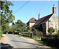
IMAGES TAKEN NEAR TO
Hook Lane, EAST GRINSTEAD, RH19 4PT

Introduction

This page details the photographs taken nearby to Hook Lane, RH19 4PT by members of the Geograph project.

The Geograph project started in 2005 with the aim of publishing, organising and preserving representative images for every square kilometre of Great Britain, Ireland and the Isle of Man.

There are currently over 7.5m images from over14,400 individuals and you can help contribute to the project by visiting https://www.geograph.org.uk

Image Map


Images are licensed for reuse under creativecommons.org/licenses/by-sa/2.0
Notes
  • Clicking on the map will re-center to the selected point.
  • The higher the marker number, the further away the image location is from the centre of the postcode.

Image Listing (13 Images Found)

Images are licensed for reuse under creativecommons.org/licenses/by-sa/2.0
Image
Details
Distance
1
House at Hook Farm on Hook Lane
Image: © Shazz Taken: 13 Jun 2011
0.00 miles
2
Hook Cottage, Hook Lane
Originally a pair of cottages built in the first decade of the 20th century now a single dwelling.
Image: © Simon Carey Taken: 13 Sep 2020
0.00 miles
3
Views to the South Downs from the Weald
Hook Lane leads down from West Hoathly to Ardingly. It's a narrow road and passes farmyards and woodland. From a bend in the road, you can enjoy the distant scenery.
Image: © Nigel Freeman Taken: 21 Jun 2005
0.02 miles
4
The Hog Pit
The name of the small wood according to West Hoathly's 1841 tithe map that is located on the western side of Hook Lane.
Image: © Simon Carey Taken: 13 Sep 2020
0.03 miles
5
Hook Farm, Hook Lane
The farmhouse is built of local sandstone and dates to at least the mid 19th century.
Image: © Simon Carey Taken: 13 Sep 2020
0.05 miles
6
Apple Tree Field
The name of the field according to West Hoathly's 1841 tithe map located to the west of Hook Lane.
Image: © Simon Carey Taken: 13 Sep 2020
0.07 miles
7
Oasis garden
Flower bed at Oasis sanctuary.
Image: © cynthia hudson Taken: 4 Jul 2010
0.08 miles
8
Bend in Hook Lane with field gate
A similar view taken six years earlier is at http://www.geograph.org.uk/photo/20490.
Image: © Shazz Taken: 13 Jun 2011
0.08 miles
9
Broom Field
The name of the field according to West Hoathly's 1841 tithe map bounded by Hook Lane to the east and Coneyburrow Wood to the west.
Image: © Simon Carey Taken: 13 Sep 2020
0.16 miles
10
Coneyburrow Wood from Hook Lane
Image: © N Chadwick Taken: 15 May 2010
0.16 miles