IMAGES TAKEN NEAR TO
Cansiron Lane, EAST GRINSTEAD, RH19 3SG
Introduction
This page details the photographs taken nearby to Cansiron Lane, RH19 3SG by members of the Geograph project.
The Geograph project started in 2005 with the aim of publishing, organising and preserving representative images for every square kilometre of Great Britain, Ireland and the Isle of Man.

There are currently over 7.5m images from over14,400 individuals and you can help contribute to the project by visiting https://www.geograph.org.uk
Image Map
Images are licensed for reuse under creativecommons.org/licenses/by-sa/2.0
Notes
- Clicking on the map will re-center to the selected point.
- The higher the marker number, the further away the image location is from the centre of the postcode.
Image Listing (47 Images Found)
Images are licensed for reuse under creativecommons.org/licenses/by-sa/2.0
Image
Details
Distance
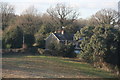
1
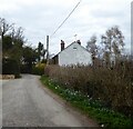
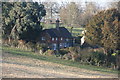
Grove Cottages, Cansiron Lane, Ashurstwood
A pair of semi-detached cottages built in the first decade of the 20th century.
Image: © Simon Carey
Taken: 7 Apr 2021
0.01 miles
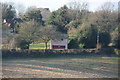
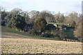
5
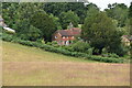
Grove Farmhouse
Grade II listed. https://historicengland.org.uk/listing/the-list/list-entry/1245461
Image: © N Chadwick
Taken: 17 Jul 2020
0.02 miles
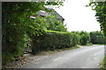
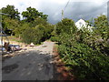
8
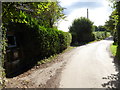
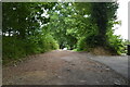
Cansiron Lane
Here the lane is a bridleway and in the centre of the picture there is a stile at a footpath junction.
Image: © Shazz
Taken: 9 Oct 2016
0.03 miles