IMAGES TAKEN NEAR TO
St. Agnes Road, EAST GRINSTEAD, RH19 3RP
Introduction
This page details the photographs taken nearby to St. Agnes Road, RH19 3RP by members of the Geograph project.
The Geograph project started in 2005 with the aim of publishing, organising and preserving representative images for every square kilometre of Great Britain, Ireland and the Isle of Man.

There are currently over 7.5m images from over14,400 individuals and you can help contribute to the project by visiting https://www.geograph.org.uk
Image Map
Images are licensed for reuse under creativecommons.org/licenses/by-sa/2.0
Notes
- Clicking on the map will re-center to the selected point.
- The higher the marker number, the further away the image location is from the centre of the postcode.
Image Listing (160 Images Found)
Images are licensed for reuse under creativecommons.org/licenses/by-sa/2.0
Image
Details
Distance
1
Pharmacy at Moatfield Surgery
View of Moatfield surgery from adjacent footpath.
Image: © Ed of the South
Taken: 20 Oct 2012
0.03 miles
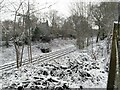
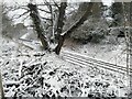
8

Thameslink Service Passing the Former St Margarets Loop
View from the Hackenden Lane bridge looking down upon the former St. Margaret's Loop and an approaching Thameslink train heading up to Bedford from East Grinstead. The service came into effect from May 2Oth.
Image: © Ed of the South
Taken: 22 May 2018
0.08 miles
9
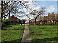
Way out to Moat Road, King George's Field, East Grinstead
Image: © Robin Webster
Taken: 12 Mar 2022
0.08 miles