IMAGES TAKEN NEAR TO
EAST GRINSTEAD, RH19 3PX
Introduction
This page details the photographs taken nearby to RH19 3PX by members of the Geograph project.
The Geograph project started in 2005 with the aim of publishing, organising and preserving representative images for every square kilometre of Great Britain, Ireland and the Isle of Man.

There are currently over 7.5m images from over14,400 individuals and you can help contribute to the project by visiting https://www.geograph.org.uk
Image Map
Images are licensed for reuse under creativecommons.org/licenses/by-sa/2.0
Notes
- Clicking on the map will re-center to the selected point.
- The higher the marker number, the further away the image location is from the centre of the postcode.
Image Listing (14 Images Found)
Images are licensed for reuse under creativecommons.org/licenses/by-sa/2.0
Image
Details
Distance
1
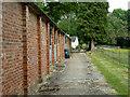
Range of buildings, Lower Stonehurst Farm
The far white building is a 20th century cottage. There are two long narrow brick buildings closer, which, if the maps are correct, are more recent and date from about 1960 - 1970. The near building has two stable doors, but these cannot account for the full length of the buildings. What were they used for?
Image: © Robin Webster
Taken: 30 May 2011
0.03 miles
2
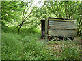
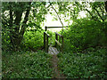
Shed in wood near Lower Stonehurst Farm
Image: © Robin Webster
Taken: 30 May 2011
0.06 miles
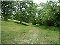
3
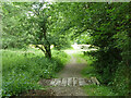
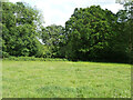
Public footpath FP403
The section from Lower Stonehurst Farm to Upper Stonehurst Farm.
Image: © Robin Webster
Taken: 30 May 2011
0.09 miles
4
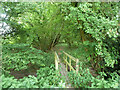
Public footpath FP403
The section from Lower Stonehurst Farm to Upper Stonehurst Farm, quite a noticeable causeway.
Image: © Robin Webster
Taken: 30 May 2011
0.15 miles
5
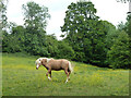
Horse with buttercups
Fields constantly grazed by horses develop a prolific growth of buttercups, which horses evidently do not like. It must become increasingly hard for the horses to avoid them and find the grass. What happens at saturation - selective weedkiller?
Image: © Robin Webster
Taken: 30 May 2011
0.15 miles
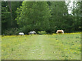
9
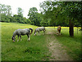
Horses on the footpath
The public footpath between Upper and Lower Stonehurst Farms follows a deliberately engineered track, which here crosses the field on a low, straight causeway.
Image: © Robin Webster
Taken: 30 May 2011
0.19 miles
10
Public footpath FP403
The section from Upper Stonehurst Farm to Lower Stonehurst Farm.
Image: © Robin Webster
Taken: 30 May 2011
0.21 miles