
IMAGES TAKEN NEAR TO
Laurel Dene, EAST GRINSTEAD, RH19 3GD
Introduction
This page details the photographs taken nearby to Laurel Dene, RH19 3GD by members of the Geograph project.
The Geograph project started in 2005 with the aim of publishing, organising and preserving representative images for every square kilometre of Great Britain, Ireland and the Isle of Man.

There are currently over 7.5m images from over14,400 individuals and you can help contribute to the project by visiting https://www.geograph.org.uk
Image Map
Images are licensed for reuse under creativecommons.org/licenses/by-sa/2.0
Notes
- Clicking on the map will re-center to the selected point.
- The higher the marker number, the further away the image location is from the centre of the postcode.
Image Listing (473 Images Found)
Images are licensed for reuse under creativecommons.org/licenses/by-sa/2.0
Image
Details
Distance
1
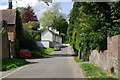
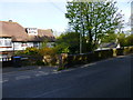
Looking into the western hemisphere, Old Road
Before about 1825, this was the old approach to the town centre from the east. The road went straight on in a cutting up a steep hill. After road diversion to the left, the road was blocked straight ahead by earthworks for the extended College Lane coming in from the right. A marker stone for the Greenwich meridian is in the right foreground.
Image: © Robin Webster
Taken: 2 May 2009
0.05 miles
3
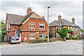
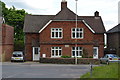
22 & 24 and 18 & 20 College Lane
Two pairs of semi-detached houses in College Lane. Nos 22 & 24, on the left, have a name/date plaque Dean Cottages 1884. Nos 18 & 20, on the right, are later, first marked on the 1910 25 inch map.
Image: © Ian Capper
Taken: 26 Sep 2023
0.06 miles
4
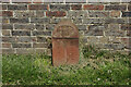
A millennium stone, Old Road, East Grinstead
One of several similar stones hereabouts, marking the Greenwich prime meridian.
Image: © Robin Webster
Taken: 2 May 2009
0.06 miles
7
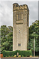
Water tower
Water tower built in 1914, designed by W Vaux-Graham. Grade II listed - see https://historicengland.org.uk/listing/the-list/list-entry/1249173?section=official-list-entry.
Image: © Ian Capper
Taken: 26 Sep 2023
0.07 miles
8
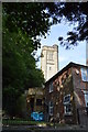
Water Tower
Grade II listed. http://www.britishlistedbuildings.co.uk/en-431040-water-tower-east-grinstead-west-sussex
Image: © N Chadwick
Taken: 31 Aug 2016
0.07 miles
9
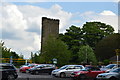
Water Tower
Grade II listed. http://www.britishlistedbuildings.co.uk/en-431040-water-tower-east-grinstead-west-sussex
Image: © N Chadwick
Taken: 23 May 2016
0.07 miles
10

Water tower
Grade II listed. http://www.britishlistedbuildings.co.uk/en-431040-water-tower-east-grinstead-west-sussex
Image: © N Chadwick
Taken: 23 May 2016
0.07 miles