IMAGES TAKEN NEAR TO
Charlwoods Road, EAST GRINSTEAD, RH19 2HJ
Introduction
This page details the photographs taken nearby to Charlwoods Road, RH19 2HJ by members of the Geograph project.
The Geograph project started in 2005 with the aim of publishing, organising and preserving representative images for every square kilometre of Great Britain, Ireland and the Isle of Man.

There are currently over 7.5m images from over14,400 individuals and you can help contribute to the project by visiting https://www.geograph.org.uk
Image Map
Images are licensed for reuse under creativecommons.org/licenses/by-sa/2.0
Notes
- Clicking on the map will re-center to the selected point.
- The higher the marker number, the further away the image location is from the centre of the postcode.
Image Listing (94 Images Found)
Images are licensed for reuse under creativecommons.org/licenses/by-sa/2.0
Image
Details
Distance

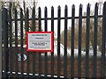
3
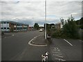
Charlwoods Road
Charlwoods Industrial Estate, including offices, and light industry. Reverse view of Image]
Image: © Barry Hunter
Taken: 3 Jul 2022
0.02 miles
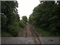
4
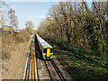
Southern train nearing East Grinstead
Unit 377 202 is leading.
Image: © Robin Webster
Taken: 23 Mar 2022
0.02 miles
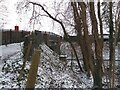
5
Hackenden Lane towards Charlwoods Road, East Grinstead
Looking from the bridge over the railway.
Image: © Robin Webster
Taken: 12 Mar 2022
0.02 miles
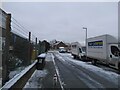
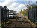
7
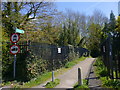
Hackenden Lane becomes restricted byway at railway bridge
Image: © Shazz
Taken: 4 May 2016
0.03 miles