IMAGES TAKEN NEAR TO
Moor Place, EAST GRINSTEAD, RH19 2EY
Introduction
This page details the photographs taken nearby to Moor Place, RH19 2EY by members of the Geograph project.
The Geograph project started in 2005 with the aim of publishing, organising and preserving representative images for every square kilometre of Great Britain, Ireland and the Isle of Man.

There are currently over 7.5m images from over14,400 individuals and you can help contribute to the project by visiting https://www.geograph.org.uk
Image Map (Loading...)


Getting Data...Please wait
Leaflet Map data © OpenStreetMap
Images are licensed for reuse under creativecommons.org/licenses/by-sa/2.0
Notes
- Clicking on the map will re-center to the selected point.
- The higher the marker number, the further away the image location is from the centre of the postcode.
Image Listing (132 Images Found)
Images are licensed for reuse under creativecommons.org/licenses/by-sa/2.0
Image
Details
Distance
1
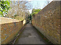
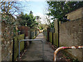
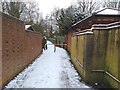
Footpath 51EG, East Grinstead
Towards a footbridge over the railway cutting formerly occupied by St Margaret's Loop. This enabled trains to and from London to reach the high level station (now no more).
Image: © Robin Webster
Taken: 12 Mar 2022
0.03 miles
3
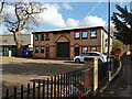
Kogo, Charlwoods Road, East Grinstead
'Professional IT support'.
Image: © Robin Webster
Taken: 12 Mar 2022
0.03 miles
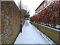
4
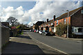
Junction of Old Town Rd, and Charlwoods Rd
Image: © Barry Hunter
Taken: 8 Feb 2021
0.03 miles
5
Flats on Charlwoods Road, East Grinstead
Image: © Robin Webster
Taken: 12 Mar 2022
0.04 miles
6
Bridge on footpath 51EG, East Grinstead
Over the railway cutting formerly occupied by St Margaret's Loop. This enabled trains to and from London to reach the high level station (now no more).
Image: © Robin Webster
Taken: 12 Mar 2022
0.04 miles
7
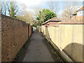
Footpath 51EG, East Grinstead
Towards a footbridge over the railway cutting formerly occupied by St Margaret's Loop. This enabled trains to and from London to reach the high level station (now no more).
Image: © Robin Webster
Taken: 12 Mar 2022
0.05 miles
8
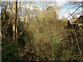
Course of old railway, East Grinstead
A rather unhelpful view from a footbridge, but illustrative of how trees take over. This was St Margaret's Loop, enabling trains to and from London to reach the high level station (now no more). Use ended in 1967.
Image: © Robin Webster
Taken: 12 Mar 2022
0.05 miles
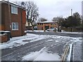
10
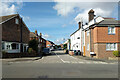
Wellington Town Road, East Grinstead
Image: © Robin Webster
Taken: 12 Mar 2022
0.05 miles