
IMAGES TAKEN NEAR TO
Railway Approach, EAST GRINSTEAD, RH19 1BZ
Introduction
This page details the photographs taken nearby to Railway Approach, RH19 1BZ by members of the Geograph project.
The Geograph project started in 2005 with the aim of publishing, organising and preserving representative images for every square kilometre of Great Britain, Ireland and the Isle of Man.

There are currently over 7.5m images from over14,400 individuals and you can help contribute to the project by visiting https://www.geograph.org.uk
Image Map
Images are licensed for reuse under creativecommons.org/licenses/by-sa/2.0
Notes
- Clicking on the map will re-center to the selected point.
- The higher the marker number, the further away the image location is from the centre of the postcode.
Image Listing (289 Images Found)
Images are licensed for reuse under creativecommons.org/licenses/by-sa/2.0
Image
Details
Distance
1
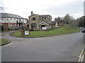
East Grinstead 1st railway station (site), West Sussex
Opened in 1855 as the terminus of a line from Three Bridges, on what became the London Brighton and South Coast Railway. The station was used by passengers only until 1866 when a second station was opened to the right of this image, on a line at a lower level (to fit under a bridge on London Road) when the line was extended to Tunbridge Wells. View west towards Rowfant and Three Bridges.
Image: © Nigel Thompson
Taken: 6 Apr 2013
0.01 miles
2
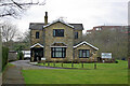
Former station house, East Grinstead
This was the location of the first station of 1855, at the terminus of the line from Three Bridges. East Grinstead has had a complicated railway history for a fairly small town. The passenger station moved to a new site on a new railway alignment in 1866 when the line was extended to Tunbridge Wells. In 1883 it moved again, with two levels, when the north-south route via Oxted to Lewes was progressively opened. Only the low level survives, with new buildings.
Image: © Robin Webster
Taken: 11 Mar 2009
0.01 miles
4
Railway Approach
Road linking London Road with the station. Mostly residential but with a small number of shops particularly nearer the junction with London Road.
Image: © Simon Carey
Taken: 20 Apr 2008
0.02 miles
5
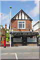
The Open Arms, East Grinstead
The micropub on Railway Approach was formerly an ink cartridge shop and before that did TV rentals. Like most micropubs it has slightly idiosyncratic opening hours and was closed in this Wednesday afternoon view.
Image: © Stephen McKay
Taken: 20 Jun 2018
0.02 miles
6
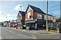
The Open Arms, East Grinstead
On Railway Approach.
Image: © Robin Webster
Taken: 12 Mar 2022
0.02 miles
7
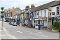
Railway Approach, East Grinstead
As the name implies, Railway Approach connects East Grinstead's town centre with the railway station. There are shops at the eastern end including those seen here.
Image: © Stephen McKay
Taken: 20 Jun 2018
0.03 miles
8
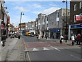
Whitehall, East Grinstead
What was once a rather stylish Art Deco shopping parade has been rather spoilt by modern indifference.
Image: © Dr Neil Clifton
Taken: 1 Apr 2008
0.03 miles
9

Railway Approach, East Grinstead
Looking towards the town centre.
Image: © Peter Trimming
Taken: 25 Jun 2014
0.03 miles
10
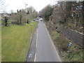
East Grinstead 2nd railway station (site), West Sussex
Opened in 1866 by the London Brighton and South Coast Railway on the line from Three Bridges to Tunbridge Wells, this station lasted until 1883 when it was replaced by a third station slightly further west and directly over the current railway station but at right angles to the platforms. View west towards Rowfant and Three Bridges, the trackbed now having been converted into a road
Image: © Nigel Thompson
Taken: 6 Apr 2013
0.03 miles