
IMAGES TAKEN NEAR TO
London Road, EAST GRINSTEAD, RH19 1AH
Introduction
This page details the photographs taken nearby to London Road, RH19 1AH by members of the Geograph project.
The Geograph project started in 2005 with the aim of publishing, organising and preserving representative images for every square kilometre of Great Britain, Ireland and the Isle of Man.

There are currently over 7.5m images from over14,400 individuals and you can help contribute to the project by visiting https://www.geograph.org.uk
Image Map
Images are licensed for reuse under creativecommons.org/licenses/by-sa/2.0
Notes
- Clicking on the map will re-center to the selected point.
- The higher the marker number, the further away the image location is from the centre of the postcode.
Image Listing (630 Images Found)
Images are licensed for reuse under creativecommons.org/licenses/by-sa/2.0
Image
Details
Distance
6
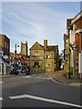
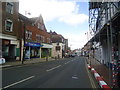
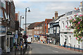
East Grinstead: view of the High Street and St Swithun's from the Ship Inn
View towards the western end of the High Street - which opens out into a broad market place beyond the big stone building. The Ship Inn stands at commanding point in the town - where West Street and Ship Street (the old coast-bound road) meet the High Street and the London Road.
Image: © Stefan Czapski
Taken: 16 Jun 2013
0.02 miles
8
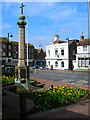
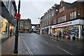
War Memorial, High Street
On the southern side of the street near the junction with London Road which is beyond Lloyds Bank.
Image: © Simon Carey
Taken: 20 Apr 2008
0.02 miles
9
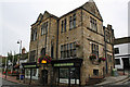
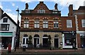
Constitutional Buildings, High Street, East Grinstead
Grade II Listed late 19th century municipal hall. Crawley News in a report about planning permission claims the hall was built in 1893. Indeed a picture in East Grinstead Through a Lens By David Gould taken about 1890 shows the Round House or West Buildings on the site prior to demolition. A picture reportedly from 1910 appears to show a set of steps up to a door in the centre of the first floor that is now a window; this is also clearly shown in a Francis Frith photo of 1895. Interestingly the street lamp on the wall outside the houses in the 1890 picture appears to be the same one on the steps to the door in Francis Frith's picture. Dorothy Hatswell in her book Secret East Grinstead tells us that the Court House once stood here and in 1684 the floor collapsed plummeting the whole trial in progress into the cellar with the exception of the judge's bench left suspended in mid air. Dorothy also reports that the building was quickly pulled down and re-built and that the last assizes were held there in 1799 (the date of the last public hanging). The Session House, rendered redundant by the loss of the assizes was variously used as a meat and vegetable market, a playhouse and presumably a market house and town hall, until demolished in 1828 during the levelling of the High Street.
Image: © Jo and Steve Turner
Taken: 20 Sep 2009
0.02 miles
