IMAGES TAKEN NEAR TO
Weir Wood, FOREST ROW, RH18 5HT
Introduction
This page details the photographs taken nearby to RH18 5HT by members of the Geograph project.
The Geograph project started in 2005 with the aim of publishing, organising and preserving representative images for every square kilometre of Great Britain, Ireland and the Isle of Man.

There are currently over 7.5m images from over14,400 individuals and you can help contribute to the project by visiting https://www.geograph.org.uk
Image Map
Images are licensed for reuse under creativecommons.org/licenses/by-sa/2.0
Notes
- Clicking on the map will re-center to the selected point.
- The higher the marker number, the further away the image location is from the centre of the postcode.
Image Listing (38 Images Found)
Images are licensed for reuse under creativecommons.org/licenses/by-sa/2.0
Image
Details
Distance
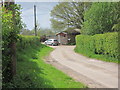
1
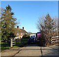
South Park Farm Cottages
A pair of cottages dating from the 19th century.
Image: © Simon Carey
Taken: 30 Jan 2022
0.00 miles
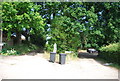
3
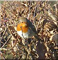
European Robin (Erithacus rubicula)
Perched in a hedgerow next to South Park Farm Cottages.
Image: © Simon Carey
Taken: 30 Jan 2022
0.04 miles
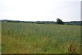
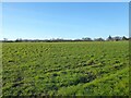
4
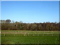
Horse Pasture
The name of the field according to East Grinstead's 1841 tithe map with Monks Wood to its north.
Image: © Simon Carey
Taken: 30 Jan 2022
0.07 miles
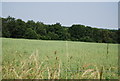
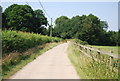
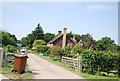
6
Eight Acres
The name of the field according to East Grinstead's 1841 tithe map with South Park Farm Cottages in the distance.
Image: © Simon Carey
Taken: 30 Jan 2022
0.08 miles