IMAGES TAKEN NEAR TO
School Lane, FOREST ROW, RH18 5EB
Introduction
This page details the photographs taken nearby to School Lane, RH18 5EB by members of the Geograph project.
The Geograph project started in 2005 with the aim of publishing, organising and preserving representative images for every square kilometre of Great Britain, Ireland and the Isle of Man.

There are currently over 7.5m images from over14,400 individuals and you can help contribute to the project by visiting https://www.geograph.org.uk
Image Map
Images are licensed for reuse under creativecommons.org/licenses/by-sa/2.0
Notes
- Clicking on the map will re-center to the selected point.
- The higher the marker number, the further away the image location is from the centre of the postcode.
Image Listing (93 Images Found)
Images are licensed for reuse under creativecommons.org/licenses/by-sa/2.0
Image
Details
Distance
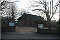
1
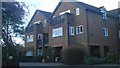
Retirement Flats
Retirement flats off Hartfield road.
Image: © cynthia hudson
Taken: 15 Jan 2012
0.06 miles
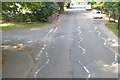
5
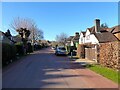
Ashdown Road, Forest Row
A private road linking Hartfield Road to Dale Road that was first developed in the 1020s.
Image: © Simon Carey
Taken: 17 Apr 2021
0.09 miles
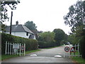
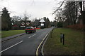
8
Hartfield Road, towards village
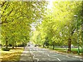
Hartfield Road in autumn, trees still in full leaf.
Image: © cynthia hudson
Taken: 17 Oct 2010
0.10 miles
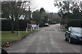
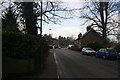
9
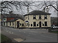
Foresters Arms - Forest Row
Sign of the times? A once popular and thriving pub is now closed and lies vacant. Who will take up the invitation of the Pub To Let sign to give it another go?
Image: © Ed of the South
Taken: 9 Mar 2012
0.10 miles