1
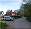
Priests House, Tompset's Bank, Forest Row
A 19th century house located at the junction with Inkpen Lane.
Image: © Simon Carey
Taken: 15 Apr 2022
0.02 miles
2
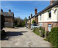
Ink Pen Lane
On the southern edge of Forest Row where several of the roads are public paths.
Image: © Dave Spicer
Taken: 11 Nov 2012
0.03 miles
3
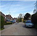
Highgate Road, Forest Row
The cottages on the right were built between the wars.
Image: © Simon Carey
Taken: 15 Apr 2022
0.07 miles
4
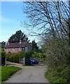
Tomtits Lane, Forest Row
The lane links Highgate Road to Thompset's Bank though that can only be achieved on foot. Up to Highgate Works the lane is surfaced, it then becomes a footpath, before returning to vehicular access, albeit with an unmade surface. The house on the left is Oak Mead.
Image: © Simon Carey
Taken: 15 Apr 2022
0.09 miles
5
Laura House, Inkpen Lane, Forest Row
Built in 1890 by a local builder, Job Luxford, for his sister Laura. Located at the junction of Highgate Road and Inkpen Lane.
Image: © Simon Carey
Taken: 15 Apr 2022
0.10 miles
6
Bryle Cottage, Tompset's Bank, Forest Row
Built in 1857 and located at the junction with Tom Tits Lane.
Image: © Simon Carey
Taken: 15 Apr 2022
0.10 miles
7
Spring Meadow, Forest Row
A cul de sac off Highgate Road built between the wars.
Image: © Simon Carey
Taken: 15 Apr 2022
0.10 miles
8
Highgate Road, Forest Row
Linking Lewes Road, the A22, and Chapel Lane. Beyond the black car on the right the road is unmade. The road itself may well run along or close to the former pale of Ashdown Forest. Chequer Farm is on the left.
Image: © Simon Carey
Taken: 12 Jun 2022
0.13 miles
9
Forest Row Sports Ground
Host to football and cricket with tennis courts to the south of the Memorial Pavilion.
Image: © Simon Carey
Taken: 15 Apr 2022
0.14 miles
10
Royal Ashdown Forest Golf Club
Image: © N Chadwick
Taken: 2 Apr 2012
0.15 miles


