
IMAGES TAKEN NEAR TO
Lewes Road, HAYWARDS HEATH, RH17 7HR
Introduction
This page details the photographs taken nearby to Lewes Road, RH17 7HR by members of the Geograph project.
The Geograph project started in 2005 with the aim of publishing, organising and preserving representative images for every square kilometre of Great Britain, Ireland and the Isle of Man.

There are currently over 7.5m images from over14,400 individuals and you can help contribute to the project by visiting https://www.geograph.org.uk
Image Map
Images are licensed for reuse under creativecommons.org/licenses/by-sa/2.0
Notes
- Clicking on the map will re-center to the selected point.
- The higher the marker number, the further away the image location is from the centre of the postcode.
Image Listing (133 Images Found)
Images are licensed for reuse under creativecommons.org/licenses/by-sa/2.0
Image
Details
Distance


4
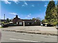
The Danehill and Chelwood Gate Social Club
Image: © PAUL FARMER
Taken: 13 Apr 2023
0.03 miles

6
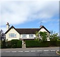
Crocodile Cottages, London Road, Danehill
The former village pub opened in the 1840s as a beer house and closed in 1987 after which it was converted into three dwellings.
Image: © Simon Carey
Taken: 20 Aug 2020
0.03 miles
8
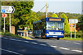
270 bus, Danehill
Metrobus 218 on the rural route 270 from East Grinstead to Haywards Heath.
Image: © Robin Webster
Taken: 27 Sep 2009
0.04 miles
10

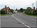
One way section of Horsted Lane
Used by traffic turning left onto the A275.
Image: © Dave Spicer
Taken: 24 Oct 2010
0.04 miles