IMAGES TAKEN NEAR TO
Old Farm Close, HAYWARDS HEATH, RH17 7GA
Introduction
This page details the photographs taken nearby to Old Farm Close, RH17 7GA by members of the Geograph project.
The Geograph project started in 2005 with the aim of publishing, organising and preserving representative images for every square kilometre of Great Britain, Ireland and the Isle of Man.

There are currently over 7.5m images from over14,400 individuals and you can help contribute to the project by visiting https://www.geograph.org.uk
Image Map
Images are licensed for reuse under creativecommons.org/licenses/by-sa/2.0
Notes
- Clicking on the map will re-center to the selected point.
- The higher the marker number, the further away the image location is from the centre of the postcode.
Image Listing (56 Images Found)
Images are licensed for reuse under creativecommons.org/licenses/by-sa/2.0
Image
Details
Distance
1
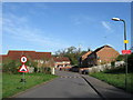
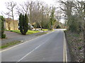
Old Farm Close
Small recently built estate constructed next to the Princess Royal Hospital. The long gap between Hurstwood Lane and the beginning of houses suggests it was built in the late 1990s as the plans for the Haywards Heath relief road, which will travel through that gap, were being formulated. Although originally part of Wivelsfield parish the land here was transferred in 1934 and is now part of Haywards Heath.
Image: © Simon Carey
Taken: 10 Apr 2011
0.04 miles
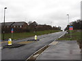
3
Disused Car Park, Princess Royal Hospital
Due to be covered by the Haywards Heath relief road in the next year or two. The houses to the left belong to Image Prior to building in the 1990s according to Wivelsfield's 1843 tithe map this was Hollow Field.
Image: © Simon Carey
Taken: 10 Apr 2011
0.06 miles
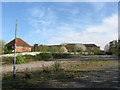
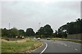
4
Country road
This is Hurstwood Lane, a bit of a 'rat run' and also used as overspill parking from the Princess Royal Hospital around the corner.
Image: © Nigel Freeman
Taken: 5 Jul 2005
0.06 miles
7
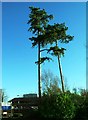
Pines, Princess Royal Hospital, Haywards Heath
Image: © nick macneill
Taken: 1 Jan 2013
0.08 miles
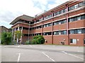
8

Princess Royal Hospital, Haywards Heath
Glass curtain walling reflecting the low sun.
Image: © Oast House Archive
Taken: 20 Dec 2009
0.09 miles
9
Outpatients building, Princess Royal Hospital
Image: © Paul Gillett
Taken: 10 Aug 2013
0.10 miles
10
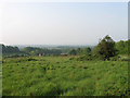
Twelve Acres
The name of the field according to Wivelsfield's 1843 tithe map viewed from Southdowns Park. The buildings below belong to Hospital Farm whilst the South Downs are just visible through the haze on the horizon. This field is earmarked for development and will have housing built upon as the Haywards Heath relief road is constructed to the south.
Image: © Simon Carey
Taken: 30 Apr 2011
0.11 miles