
IMAGES TAKEN NEAR TO
Station Road, HAYWARDS HEATH, RH17 7AT
Introduction
This page details the photographs taken nearby to Station Road, RH17 7AT by members of the Geograph project.
The Geograph project started in 2005 with the aim of publishing, organising and preserving representative images for every square kilometre of Great Britain, Ireland and the Isle of Man.

There are currently over 7.5m images from over14,400 individuals and you can help contribute to the project by visiting https://www.geograph.org.uk
Image Map
Images are licensed for reuse under creativecommons.org/licenses/by-sa/2.0
Notes
- Clicking on the map will re-center to the selected point.
- The higher the marker number, the further away the image location is from the centre of the postcode.
Image Listing (302 Images Found)
Images are licensed for reuse under creativecommons.org/licenses/by-sa/2.0
Image
Details
Distance
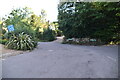
2
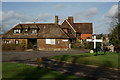
Horsted Keynes, Sussex
Looking across the green, towards The Forge. In the distance, the church of St. Giles can be seen.
Image: © Peter Trimming
Taken: 2 Feb 2014
0.01 miles
3
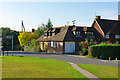
The Forge, Horsted Keynes
And associated cottages, all residential now.
Image: © Robin Webster
Taken: 27 Sep 2009
0.01 miles
5
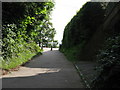
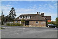
The southern end of Church Lane
This short stretch of road is prohibited to cars due to dangerous exit onto main road
Image: © Dave Spicer
Taken: 8 Aug 2009
0.01 miles
6
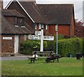
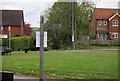
Roadsign at the village crossroad, Horsted Keynes
Image: © N Chadwick
Taken: 16 May 2010
0.01 miles
10
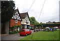
The Green Man, Horsted Keynes
A good village pub serving good beer and food.
Image: © N Chadwick
Taken: 16 May 2010
0.02 miles