1
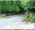
Gateway to Knoll Wood House
See also http://www.geograph.org.uk/photo/1660320.
Image: © Shazz
Taken: 4 Oct 2016
0.01 miles
2
Broadhurst Wood, Handcross Road
Built in the late 19th century as the main dwelling for Forest Nurseries which operated here and the adjacent field,
Image, up to at least the Second World War. It is called by its current name by the 1957 OS map taking it from the wood that lies to the immediate west.
Image: © Simon Carey
Taken: 25 Jul 2015
0.01 miles
3
Waiting for the rubbish collection
The road here, particularly to the left, was in a bad state, so no rubbish lorry will come this way until the thaw really sets in.
Image: © Robin Webster
Taken: 12 Jan 2010
0.03 miles
4
Private road
This connects Handcross Road with High Street, and serves several well-spaced desirable properties. Not often used as a through route, as the northern end is unsurfaced, and the junction with High Street does not have good sighting.
Image: © Robin Webster
Taken: 12 Jan 2010
0.04 miles
5
Victorian Post Box, Handcross Lane, near Balcombe, West Sussex
Situated at the junction of an unclassified private lane to several private houses. The post box is mounted into a brick built pillar.
Image: © Pete Chapman
Taken: 28 Jul 2005
0.04 miles
6
Drive and Royal Mail post box on Handcross Road
See also http://www.geograph.org.uk/photo/31424.
Image: © Shazz
Taken: 4 Oct 2016
0.05 miles
7
Sheep Field
The name of the field according to Balcombe's 1839 tithe map which is triangular in shape and is bordered by Handcross Road to the north. Towards the end of the 19th century the field became part of Forest Nursery with a dwelling built at the western end, see
Image, and much of what is in view turned into an orchard. This remained so until the Second World War when the nurseries closed. The field appears to have been grubbed sometime in the 1970s.
Image: © Simon Carey
Taken: 25 Jul 2015
0.08 miles
8
House in the Wood, Handcross Road
The name of the house that appears to have been built between the wars in the north west portion of Broadhurst Wood. Viewed from Handcross Road.
Image: © Simon Carey
Taken: 25 Jul 2015
0.12 miles
9
Logs, Handcross Road
Piled up on the eastern side of a track that heads south into Brantridge Wood.
Image: © Simon Carey
Taken: 25 Jul 2015
0.14 miles
10
Water Works, Handcross Road
First opened in the late 19th century as Mid Sussex Water Works and still used today. The building in the foreground is Fernbridge Cottage and appears to be a separate dwelling though once part of the works.
Image: © Simon Carey
Taken: 25 Jul 2015
0.14 miles


