IMAGES TAKEN NEAR TO
Redbridge Lane, HAYWARDS HEATH, RH17 6PN
Introduction
This page details the photographs taken nearby to Redbridge Lane, RH17 6PN by members of the Geograph project.
The Geograph project started in 2005 with the aim of publishing, organising and preserving representative images for every square kilometre of Great Britain, Ireland and the Isle of Man.

There are currently over 7.5m images from over14,400 individuals and you can help contribute to the project by visiting https://www.geograph.org.uk
Image Map
Images are licensed for reuse under creativecommons.org/licenses/by-sa/2.0
Notes
- Clicking on the map will re-center to the selected point.
- The higher the marker number, the further away the image location is from the centre of the postcode.
Image Listing (128 Images Found)
Images are licensed for reuse under creativecommons.org/licenses/by-sa/2.0
Image
Details
Distance
1
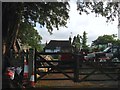
Little Coopers Corner Cottage, Handcross Road, Balcombe
The house dates from the 16th century and was the original farmhouse for Image On Balcombe's 1839 tithe map it was recorded as a public house called the Navigators Arms Inn, one of six mentioned in that survey. Judging by the name and its position near the railway line this appears to have been a little business opportunity by the then owner to provide a service for the thousands of thirsty navvies constructing the new London-Brighton railway. Once the line opened in 1841 the clientele disappeared and the former pub most likely reverted to being a farmhouse again.
Image: © Simon Carey
Taken: 25 Jul 2015
0.00 miles
2

Handcross Road
Taken at the junction of the B2036 London Road from the churchyard at St Mary's Church.
Image: © Kevin Gordon
Taken: 18 Oct 2008
0.05 miles
3
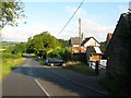
Little Coopers Corner, Handcross Road, Balcombe
The barns on the right once belonged to Image which appears to have been replaced in the first decade of the 20th century by Little Coopers Farmhouse whose roof is visible beyond.
Image: © Simon Carey
Taken: 25 Jul 2015
0.05 miles
4
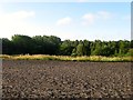
Pond Field
The name of the field according to Balcombe's 1839 tithe map that lies to the south of Handcross Road opposite Image and is now a series of paddocks.
Image: © Simon Carey
Taken: 25 Jul 2015
0.06 miles
5
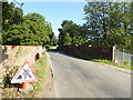
Looking east along Handcross Road across Red Bridge
This bridge is over the Brighton line.
Image: © Shazz
Taken: 4 Oct 2016
0.07 miles
7
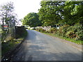
Approach to the railway bridge on Handcross Road
Image: © Shazz
Taken: 4 Oct 2016
0.11 miles
8
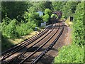
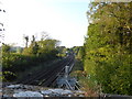
Red Bridge
Carrying Handcross Lane over the London-Brighton railway. Viewed from Westup Road bridge with Redbridge Cottages on the left.
Image: © Simon Carey
Taken: 4 Jul 2015
0.11 miles