
IMAGES TAKEN NEAR TO
Combers, HAYWARDS HEATH, RH17 6NE
Introduction
This page details the photographs taken nearby to Combers, RH17 6NE by members of the Geograph project.
The Geograph project started in 2005 with the aim of publishing, organising and preserving representative images for every square kilometre of Great Britain, Ireland and the Isle of Man.

There are currently over 7.5m images from over14,400 individuals and you can help contribute to the project by visiting https://www.geograph.org.uk
Image Map
Images are licensed for reuse under creativecommons.org/licenses/by-sa/2.0
Notes
- Clicking on the map will re-center to the selected point.
- The higher the marker number, the further away the image location is from the centre of the postcode.
Image Listing (116 Images Found)
Images are licensed for reuse under creativecommons.org/licenses/by-sa/2.0
Image
Details
Distance
1
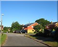
Combers, Balcombe
A cul de sac off Haywards Heath Road built during the 1960s.
Image: © Simon Carey
Taken: 18 Jul 2015
0.01 miles
3
Haywards Heath Road, Balcombe
The minor C road that links Balcombe to Haywards Heath. The entrance to Combers is on the left.
Image: © Simon Carey
Taken: 27 Jun 2015
0.03 miles
5

Concrete public bridleway marker, Barn Meadow, Balcombe
Concrete public bridleway marker at the start of a public bridleway adjacent to the entrance to Barn Meadow, Balcombe
Image: © Daniel Beardsmore
Taken: 19 Jul 2025
0.04 miles
6

Concrete public bridleway marker, Barn Meadow, Balcombe
Concrete public bridleway marker at the start of a public bridleway adjacent to the entrance to Barn Meadow, Balcombe.
Image: © Daniel Beardsmore
Taken: 19 Jul 2025
0.04 miles
7
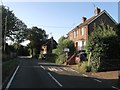
Cottages, Haywards Heath Road, Balcombe
On the right the semi detached Edwardian cottages are Oakleigh and Fernleigh respectively whilst beyond is the much older Yew Tree Cottage which dates from the 17th century.
Image: © Simon Carey
Taken: 18 Jul 2015
0.05 miles
8
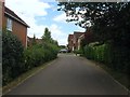
The Nurseries, Balcombe
A small cul de sac off Deanlands Road which as the name suggests was built over the site of a former nursery sometime in the last 20 years.
Image: © Simon Carey
Taken: 27 Jun 2015
0.05 miles
9
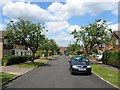
Foxwells, Balcombe
A cul de sac off Oldlands Road built in the 1960s on the site of a former nursery which itself was located in a former field called Miley Field according to Balcombe's 1839 tithe map.
Image: © Simon Carey
Taken: 27 Jun 2015
0.05 miles
10
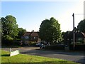
Meadow Close, Balcombe
A very small cul de sac off seven dwellings of Haywards Heath Road that was built between the wars.
Image: © Simon Carey
Taken: 18 Jul 2015
0.05 miles