IMAGES TAKEN NEAR TO
Oldlands Avenue, HAYWARDS HEATH, RH17 6NA
Introduction
This page details the photographs taken nearby to Oldlands Avenue, RH17 6NA by members of the Geograph project.
The Geograph project started in 2005 with the aim of publishing, organising and preserving representative images for every square kilometre of Great Britain, Ireland and the Isle of Man.

There are currently over 7.5m images from over14,400 individuals and you can help contribute to the project by visiting https://www.geograph.org.uk
Image Map
Images are licensed for reuse under creativecommons.org/licenses/by-sa/2.0
Notes
- Clicking on the map will re-center to the selected point.
- The higher the marker number, the further away the image location is from the centre of the postcode.
Image Listing (95 Images Found)
Images are licensed for reuse under creativecommons.org/licenses/by-sa/2.0
Image
Details
Distance
1
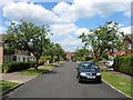
Foxwells, Balcombe
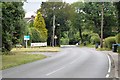
A cul de sac off Oldlands Road built in the 1960s on the site of a former nursery which itself was located in a former field called Miley Field according to Balcombe's 1839 tithe map.
Image: © Simon Carey
Taken: 27 Jun 2015
0.03 miles
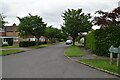
5

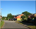
Oldlands Avenue, Balcombe
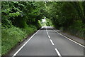
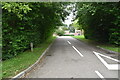
Mapped as having a public footpath along its length, so presumably a private road, although used as a public road.
Image: © Robin Webster
Taken: 17 Mar 2010
0.06 miles
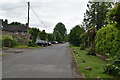
6
Combers, Balcombe
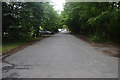
A cul de sac off Haywards Heath Road built during the 1960s.
Image: © Simon Carey
Taken: 18 Jul 2015
0.06 miles