IMAGES TAKEN NEAR TO
Slough Green Lane, HAYWARDS HEATH, RH17 5SL
Introduction
This page details the photographs taken nearby to Slough Green Lane, RH17 5SL by members of the Geograph project.
The Geograph project started in 2005 with the aim of publishing, organising and preserving representative images for every square kilometre of Great Britain, Ireland and the Isle of Man.

There are currently over 7.5m images from over14,400 individuals and you can help contribute to the project by visiting https://www.geograph.org.uk
Image Map
Images are licensed for reuse under creativecommons.org/licenses/by-sa/2.0
Notes
- Clicking on the map will re-center to the selected point.
- The higher the marker number, the further away the image location is from the centre of the postcode.
Image Listing (19 Images Found)
Images are licensed for reuse under creativecommons.org/licenses/by-sa/2.0
Image
Details
Distance
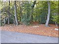
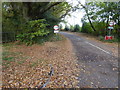
1
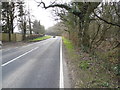
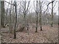
Sloughgreen Lane
Holmsted Wood is on the right
Image: © David Howard
Taken: 7 Apr 2013
0.11 miles
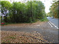
2
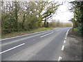
Sloughgreen Lane
Holmsted Wood is on the left
Image: © David Howard
Taken: 7 Apr 2013
0.11 miles
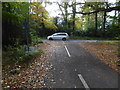
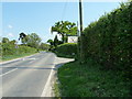
5
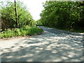
Mallion's Lane junction with Slough Green Lane
Image: © Dave Spicer
Taken: 23 Apr 2011
0.14 miles
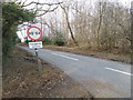
8
The B2115 looking east from the junction with Mallion's Lane
See also http://www.geograph.org.uk/photo/2379329.
Image: © Shazz
Taken: 6 Nov 2016
0.15 miles
9
The southern end of Mallion's Lane
See also http://www.geograph.org.uk/photo/3400707.
Image: © Shazz
Taken: 6 Nov 2016
0.16 miles
10
Paternosters Farm Shop
On the south side of the B2115.
Image: © Dave Spicer
Taken: 23 Apr 2011
0.16 miles