IMAGES TAKEN NEAR TO
Brighton Road, HAYWARDS HEATH, RH17 5GH

Introduction

This page details the photographs taken nearby to Brighton Road, RH17 5GH by members of the Geograph project.

The Geograph project started in 2005 with the aim of publishing, organising and preserving representative images for every square kilometre of Great Britain, Ireland and the Isle of Man.

There are currently over 7.5m images from over14,400 individuals and you can help contribute to the project by visiting https://www.geograph.org.uk

Image Map


Images are licensed for reuse under creativecommons.org/licenses/by-sa/2.0
Notes
  • Clicking on the map will re-center to the selected point.
  • The higher the marker number, the further away the image location is from the centre of the postcode.

Image Listing (43 Images Found)

Images are licensed for reuse under creativecommons.org/licenses/by-sa/2.0
  • ...
Image
Details
Distance
1
Ricebridge Works, Brighton Road
A business park on the old A23 with this relatively new section containing a Golf Trolley shop, a gym and a bathroom specialist, occupying the site of a former garage. See also Image
Image: © Simon Carey Taken: 23 Aug 2014
0.00 miles
2
Ricebridge Works by the A23
Image: © Dave Spicer Taken: 6 Mar 2011
0.01 miles
3
Ricebridge Works, Brighton Road
Eclipse Roofing Supplies is the business occupying the unit behind the house. See also Image
Image: © Simon Carey Taken: 23 Aug 2014
0.03 miles
4
No footpath crossing the A23 at Rice Bridge
The start of Footpath 16Bo, on the east side of the A23 at the entrance to Chaites Farm, seen from the end of Image There is no footpath crossing the A23 at this point: there are no signs pointing across the carriageways; no breaks in the barriers; no bridge and no tunnel.
Image: © Andy Potter Taken: 21 Sep 2006
0.04 miles
5
The old A23, Hickstead
Image: © David Howard Taken: 9 Aug 2018
0.05 miles
6
Ricebridge Business Park, Hickstead
At Rice Bridge, on the north-bound slip road on the A23 at Hickstead.
Image: © Andy Potter Taken: 21 Sep 2006
0.05 miles
7
Brighton Road
Looking southwards towards the slip road from Image which is about a mile long and follows the old course of the A23, replaced by the dual carriageway in the early 1990s. The construction of that road saw the demolition of Chaites Farm Cottages and Webber's Barn which were located on the right side and to the north of the pylon.
Image: © Simon Carey Taken: 23 Aug 2014
0.06 miles
8
Crossing the A23
The camera looks back at the crossing just made across the dual carriageway from the end of a footpath at the right of the larger building. Although no vehicles are seen in the picture it is a busy road and I found it quite terrifying. Safer options are three quarters of a mile to the south at Hickstead using the A2300 or a similar distance north on the A272!
Image: © Shazz Taken: 18 Nov 2016
0.06 miles
9
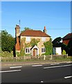
Little Garston, Brighton Road
A 19th century cottage on the old A23 near to its junction with its current course.
Image: © Simon Carey Taken: 23 Aug 2014
0.07 miles
10
Little Garstons Cottages, Brighton Road
Built in the first decade of the 20th century on a plot that had a limekiln on it according to the 1875 OS map. The cottages are located to the north of Image and are viewed from the eastern side of the A23 at roughly the point where Webber's Barn once stood, with it and an adjacent pair of cottages being demolished to make way for the rerouting to the dual carriageway in the early 1990s.
Image: © Simon Carey Taken: 5 Oct 2014
0.08 miles
  • ...