
IMAGES TAKEN NEAR TO
Brock End, HAYWARDS HEATH, RH17 5BU
Introduction
This page details the photographs taken nearby to Brock End, RH17 5BU by members of the Geograph project.
The Geograph project started in 2005 with the aim of publishing, organising and preserving representative images for every square kilometre of Great Britain, Ireland and the Isle of Man.

There are currently over 7.5m images from over14,400 individuals and you can help contribute to the project by visiting https://www.geograph.org.uk
Image Map
Images are licensed for reuse under creativecommons.org/licenses/by-sa/2.0
Notes
- Clicking on the map will re-center to the selected point.
- The higher the marker number, the further away the image location is from the centre of the postcode.
Image Listing (63 Images Found)
Images are licensed for reuse under creativecommons.org/licenses/by-sa/2.0
Image
Details
Distance
1
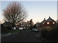
Brock End, Whitemans Green
A cul de sac off London Road built in the 1970s on the site of a former builders yard.
Image: © Simon Carey
Taken: 6 Dec 2014
0.01 miles
2
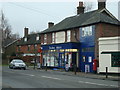
Post office and store, Whitemans Green, Cuckfield
Image: © Stacey Harris
Taken: 23 Jan 2010
0.02 miles
3
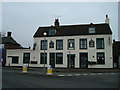
The Ship Inn public house, Whitemans Green, Cuckfield
Image: © Stacey Harris
Taken: 23 Jan 2010
0.03 miles
4
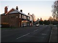
Wealden Stores, London Road, Whitemans Green
The local shop sources much of its content locally and also contains a post office, however, it has recently come under threat by the neighbouring pub, The Ship, being converted into a small Co-op convenience store.
Image: © Simon Carey
Taken: 6 Dec 2014
0.03 miles
5
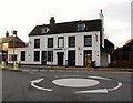
The Co-Op, London Road, Whitemans Green
Opened in 2014 on the site of the former Ship Inn a decision that has not gone down very well with the locals. The building had been a pub for 200 years making the most of being on the old London-Brighton turnpike and was still active in the local community in 2014 when the previous landlord couple decided to sell on their retirement. The new buyer was the owner of a pub in Lingfield but whose family were property developers who made their money converting pubs into Co-Ops. After the pub closed in the summer much building work was seen but the conversion notice was only posted in October with the shop opening a few weeks later. Locals have protested vociferously about this underhand activity staging a sit in the following month and many are concerned with the future of neighbouring Image which has served as the village post office and stores for over a hundred years and sources much of its content from the locality.
Another case of the major supermarkets undercutting independents and riding roughshod over the wishes of the locals - should you find yourself in the vicinity ignore the store and go next door.
Image: © Simon Carey
Taken: 20 Dec 2014
0.03 miles
6
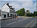
Whiteman's Green and the Ship
The Ship Inn serves good food. Whiteman's Green to many people in the locale means the large playing field area not far from this pub.
Image: © Nigel Freeman
Taken: 26 Jun 2005
0.03 miles
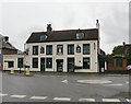
8
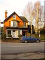
Allenby House, London Road, Whitemans Green
Built in the victorian period as a shop and dwelling though the former has long since gone though it retains the former shop front.
Image: © Simon Carey
Taken: 20 Dec 2014
0.04 miles
9
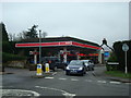
Petrol Station, Whitemans Green, Cuckfield
Image: © Stacey Harris
Taken: 23 Jan 2010
0.04 miles
10
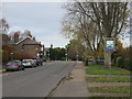
London Road , Cuckfield
A view up the road out of the village, despite the Cuckfield sign suggesting you are entering (to be fair, the sign is two sided).
Image: © Richard Rogerson
Taken: 13 Nov 2017
0.04 miles