
IMAGES TAKEN NEAR TO
The Dell, HAYWARDS HEATH, RH17 5AD
Introduction
This page details the photographs taken nearby to The Dell, RH17 5AD by members of the Geograph project.
The Geograph project started in 2005 with the aim of publishing, organising and preserving representative images for every square kilometre of Great Britain, Ireland and the Isle of Man.

There are currently over 7.5m images from over14,400 individuals and you can help contribute to the project by visiting https://www.geograph.org.uk
Image Map
Images are licensed for reuse under creativecommons.org/licenses/by-sa/2.0
Notes
- Clicking on the map will re-center to the selected point.
- The higher the marker number, the further away the image location is from the centre of the postcode.
Image Listing (73 Images Found)
Images are licensed for reuse under creativecommons.org/licenses/by-sa/2.0
Image
Details
Distance
1
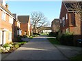
The Dell, Cuckfield
A recently built cul de sac off Image that occupies a former field called Knowles Mead according to Cuckfield's 1843 tithe map. The oak in view is the lone survivor of a former field boundary.
Image: © Simon Carey
Taken: 20 Dec 2014
0.01 miles
3
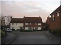
Ashburnham Drive, Cuckfield
Small estate off High Street completed in the last few years with this section occupying a former field called Pearces Mead according to Cuckfield's 1843 tithe map.
Image: © Simon Carey
Taken: 29 Nov 2014
0.03 miles
4
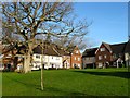
Waterhouse Square, Cuckfield
Part of a small estate developed in the last decade. The oak is a lone survivor of a former hedgerow that once separated Knowles Mead to the west with Pearces Mead to the east, according to Cuckfield's 1843 tithe map.
Image: © Simon Carey
Taken: 20 Dec 2014
0.05 miles
5
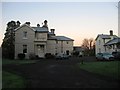
The Tower House, Tower House Close, Cuckfield
Large Victorian house built on a former field called Jenners Mead according to Cuckfield's 1843 tithe map. The grounds of the house NOW contain Tower House Close, a small retirement estate, built in the late 1970s.
Image: © Simon Carey
Taken: 6 Dec 2014
0.07 miles
6
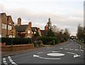
Percy Cottages, London Road, Cuckfield
Three pairs of semi-detached cottages located opposite the Rose and Crown Inn which were built in the first decade of the 20th century on the site of a former house called Percys. The roundabout marks the spot where High Street, London Lane and London Road all meet.
Image: © Simon Carey
Taken: 20 Dec 2014
0.10 miles
7
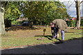
Fetching Water in Cuckfield, Sussex
The veteran car Image] needed a top-up of water.
Image: © Christine Matthews
Taken: 3 Nov 2013
0.10 miles
8
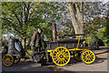
Veteran Car (Steam Powered), Cuckfield, Sussex
The car was waiting for a top-up of water.
Image: © Christine Matthews
Taken: 3 Nov 2013
0.10 miles
10
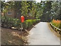
New residential road off the High Street
The road to the right is Ashburnham Drive a fairly new housing area not shown on Google aerial shot.
Image: © Dave Spicer
Taken: 10 Jul 2011
0.10 miles