IMAGES TAKEN NEAR TO
Brighton Road, REDHILL, RH1 6PX
Introduction
This page details the photographs taken nearby to Brighton Road, RH1 6PX by members of the Geograph project.
The Geograph project started in 2005 with the aim of publishing, organising and preserving representative images for every square kilometre of Great Britain, Ireland and the Isle of Man.

There are currently over 7.5m images from over14,400 individuals and you can help contribute to the project by visiting https://www.geograph.org.uk
Image Map
Images are licensed for reuse under creativecommons.org/licenses/by-sa/2.0
Notes
- Clicking on the map will re-center to the selected point.
- The higher the marker number, the further away the image location is from the centre of the postcode.
Image Listing (160 Images Found)
Images are licensed for reuse under creativecommons.org/licenses/by-sa/2.0
Image
Details
Distance
1
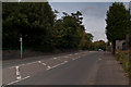
The Cutting
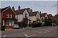
The point at which the Brighton Road crosses the "Red Hill" required a shallow cutting, hence the name of this stretch of road. It wasn't originally built up - these houses date from around the 1920s.
Image: © Ian Capper
Taken: 24 Sep 2011
0.01 miles
2
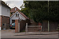
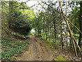
Footpath to St Johns
Footpath off The Cutting, Brighton Road, leading to St Johns Church.
Image: © Ian Capper
Taken: 24 Sep 2011
0.04 miles
3
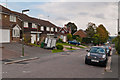
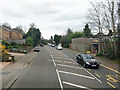
St John's Road
St John's Road originally ran from Hooley Lane through to The Cutting. This last section, has now had its access to The Cutting blocked, leaving it as a cul-de-sac.
Image: © Ian Capper
Taken: 24 Sep 2011
0.04 miles
5
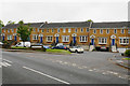
The Cutting
The point at which the Brighton Road crosses the "Red Hill" required a shallow cutting, hence the name of this stretch of road.
Image: © Ian Capper
Taken: 24 Sep 2011
0.05 miles
7

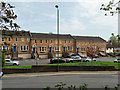
The Flying Scud public house, Earlswood
Image: © Stacey Harris
Taken: 23 Jan 2010
0.06 miles
8
A23 Brighton Road towards Redhill
Surmounting the ridge at old Earlswood.
Image: © Robin Webster
Taken: 23 Mar 2019
0.06 miles
9
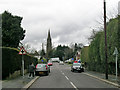
St John's Road
Looking up the road to the A23 at the end, with St John's church beyond. This road has long been blocked of from direct access to the A23, and a right or left turn is necessary at the crossroads ahead.
Image: © Robin Webster
Taken: 25 Mar 2010
0.06 miles
10
Path down to Sandpit Road, Redhill Common
This is a wooded part of the common, with overgrown old sandpits.
Image: © Robin Webster
Taken: 21 Apr 2018
0.06 miles