IMAGES TAKEN NEAR TO
Brambletye Park Road, REDHILL, RH1 6EN
Introduction
This page details the photographs taken nearby to Brambletye Park Road, RH1 6EN by members of the Geograph project.
The Geograph project started in 2005 with the aim of publishing, organising and preserving representative images for every square kilometre of Great Britain, Ireland and the Isle of Man.

There are currently over 7.5m images from over14,400 individuals and you can help contribute to the project by visiting https://www.geograph.org.uk
Image Map
Images are licensed for reuse under creativecommons.org/licenses/by-sa/2.0
Notes
- Clicking on the map will re-center to the selected point.
- The higher the marker number, the further away the image location is from the centre of the postcode.
Image Listing (37 Images Found)
Images are licensed for reuse under creativecommons.org/licenses/by-sa/2.0
Image
Details
Distance
2
Earlswood Recreation Ground
Between Althorne Road and Ifold Road (beyond the railings). In the background is one of the gasometers in Hooley Lane (see Image).
Image: © Ian Capper
Taken: 15 Mar 2009
0.12 miles
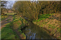
4
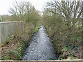
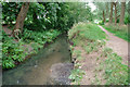
Redhill Brook
Viewed from the bridge on Brambletye Park Road. North of this bridge it seems to be largely culverted.
Image: © Robin Webster
Taken: 25 Mar 2010
0.14 miles
5
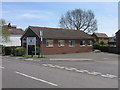
Earlswood Baptist Church
Dating from 1963.
Image: © Ian Capper
Taken: 26 Apr 2008
0.18 miles
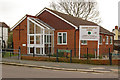
6
Earlswood Baptist Church, Redhill Surrey
Image: © Richard Rogerson
Taken: 5 Aug 2009
0.18 miles
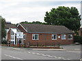
7
Earlswood Baptist Church
Compare Image - now refurbished, with a new entrance.
Image: © Ian Capper
Taken: 6 Mar 2010
0.18 miles
8

Weir on Redhill Brook
There is no weir mapped just here, but there was once a small sewage works on the opposite bank which in earlier maps is called a gas works. Memory fails if this was actually in the brook or a side outfall, again, maps do not help.
Image: © Robin Webster
Taken: 14 Jul 2010
0.18 miles
9
Redhill Brook
Flats in Princes Road just visible in the background.
Image: © Ian Capper
Taken: 21 Mar 2009
0.18 miles
10
The Redhill Brook
Most of the drainage above this point must come from urban run-off, it emerged from under the streets of Redhill about 250 m upstream.
Image: © Robin Webster
Taken: 14 Jul 2010
0.19 miles