IMAGES TAKEN NEAR TO
Lower Village, HAYWARDS HEATH, RH16 4GR
Introduction
This page details the photographs taken nearby to Lower Village, RH16 4GR by members of the Geograph project.
The Geograph project started in 2005 with the aim of publishing, organising and preserving representative images for every square kilometre of Great Britain, Ireland and the Isle of Man.

There are currently over 7.5m images from over14,400 individuals and you can help contribute to the project by visiting https://www.geograph.org.uk
Image Map
Images are licensed for reuse under creativecommons.org/licenses/by-sa/2.0
Notes
- Clicking on the map will re-center to the selected point.
- The higher the marker number, the further away the image location is from the centre of the postcode.
Image Listing (42 Images Found)
Images are licensed for reuse under creativecommons.org/licenses/by-sa/2.0
Image
Details
Distance
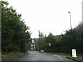
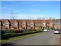
1
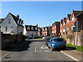
Lower Village, Bolnore Village
This section runs between Cherry Place and Lower Village Street.
Image: © Simon Carey
Taken: 7 Mar 2015
0.01 miles
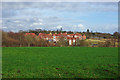
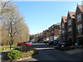
2
Juniper Court, Bolnore Village
The southern part of the housing which overlooks a small stream beyond which is Image
Image: © Simon Carey
Taken: 7 Mar 2015
0.05 miles
3
Bolnore - new housing development
The most southern cluster of houses and flats of this new development.
Image: © Robin Webster
Taken: 26 Mar 2010
0.05 miles
4
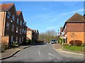
Lower Village, Bolnore Village
This section of the road runs between Lower Village Street and Traunstein Way, the A272 relief road.
Image: © Simon Carey
Taken: 7 Mar 2015
0.05 miles
6
Brooklands, Bolnore Village
A cul de sac off Lower Village Street which is located opposite Image and is separated by a small stream.
Image: © Simon Carey
Taken: 7 Mar 2015
0.07 miles
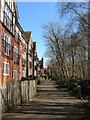
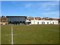
7
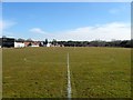
Tim Farmer Recreation Ground, Bolnore Village
Originally known as Bolnore Village Recreation Ground it was renamed in memory of a local Conservative councillor who passed away after battling cancer during the summer of 2014. To the left is Image Much of the recreation ground was once Eleven Acre Wood. See also Image
Image: © Simon Carey
Taken: 7 Mar 2015
0.08 miles
8
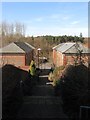
Steps to Brooklands, Bolnore Village
A feature of the estate is the large number of paths that link various roads with this one heading down to Brooklands from Highbank. Eleven Acre Wood can be seen in the distance.
Image: © Simon Carey
Taken: 7 Mar 2015
0.08 miles
9
Roundway, Bolnore Village
The road heads south from Highbank allowing access to Kingfisher Drive.
Image: © Simon Carey
Taken: 7 Mar 2015
0.08 miles
10
Woodside, Bolnore Village
Bolnore village will eventually contain over 800 homes housing over 2000 residents yet little provision has been made for services to this community, there is no church or pub, and only one shop. As a consequence the residents have battled and succeeded in getting this building constructed which will act as a community centre and at present contains the only licensed premises in the village.
Image: © Simon Carey
Taken: 7 Mar 2015
0.11 miles