
IMAGES TAKEN NEAR TO
Butlers Green Road, HAYWARDS HEATH, RH16 4BN
Introduction
This page details the photographs taken nearby to Butlers Green Road, RH16 4BN by members of the Geograph project.
The Geograph project started in 2005 with the aim of publishing, organising and preserving representative images for every square kilometre of Great Britain, Ireland and the Isle of Man.

There are currently over 7.5m images from over14,400 individuals and you can help contribute to the project by visiting https://www.geograph.org.uk
Image Map
Images are licensed for reuse under creativecommons.org/licenses/by-sa/2.0
Notes
- Clicking on the map will re-center to the selected point.
- The higher the marker number, the further away the image location is from the centre of the postcode.
Image Listing (83 Images Found)
Images are licensed for reuse under creativecommons.org/licenses/by-sa/2.0
Image
Details
Distance
1
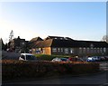
Linwood Community Mental Health Centre, Butlers Green Road, Haywards Heath
Occupying part of the former Haywards heath Hospital which was located here from 1912 until the 1990s when all services were moved to the newly opened Princess Royal. Originally opened as a cottage hospital in Ashenground Road in 1906 it moved here in 1912 and was renamed the King Edward VII Memorial Hospital before becoming the Haywards Heath Hospital in 1973
Image: © Simon Carey
Taken: 8 Feb 2015
0.03 miles
2
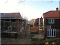
New Development, Haywards Heath
Currently being built on the western edge of the town in a former field called Wig Perry Mead according to Cuckfield's 1843 tithe map. The field name itself lives on in Image whilst the new development is accessed at the southern end of Image
Image: © Simon Carey
Taken: 8 Feb 2015
0.06 miles
3
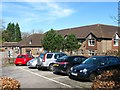
Beech Hurst, Butlers Green Road, Haywards Heath
A purpose built care home built in the grounds of the former Haywards Heath Hospital.
Image: © Simon Carey
Taken: 12 Apr 2015
0.06 miles
4
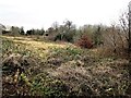
Rough Field by Butler's Shaw
This rough field with Butler's Shaw on the right has now been developed (2017) as a housing estate on the western outskirts of Haywards Heath
Image: © Patrick Roper
Taken: 9 Jan 2012
0.07 miles
5
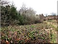
Butler's Shaw and neighbouring field
Butler's Shaw, on the left of the photo, is a small area of ancient woodland on the western outskirts of Haywards Heath. The neglected field on the right of the picture has now (2017) been developed as a housing estate.
Image: © Patrick Roper
Taken: 9 Jan 2012
0.07 miles
6
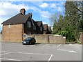
Beech Hurst Cottages, Butlers Green Road, Haywards Heath
The five cottages were built in the grounds of Beech Hurst in the late 19th century and are now accessed via the car park provided for those visiting the park.
Image: © Simon Carey
Taken: 30 Mar 2015
0.07 miles
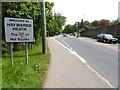
8
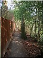
Footpath to Lucastes Road, Haywards Heath
Currently linking Sherwood Drive to Lucastes Road. To the south is a new development being built called Lucastes.
Image: © Simon Carey
Taken: 12 Apr 2015
0.08 miles
9
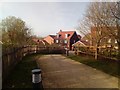
Footpath connecting Butlers Green Road and Knights Close
Image: © Thoma
Taken: 3 Apr 2017
0.08 miles
10
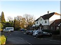
Beech Hurst, Butlers Green Road, Haywards Heath
The pub was built in the 1950s after the local council acquired the estate of Beech Hurst demolished the former Victorian villa and landscaped the gardens into a public park. Currently a Harvester carvery.
Image: © Simon Carey
Taken: 8 Feb 2015
0.08 miles