
IMAGES TAKEN NEAR TO
Allen Road, HAYWARDS HEATH, RH16 3PU
Introduction
This page details the photographs taken nearby to Allen Road, RH16 3PU by members of the Geograph project.
The Geograph project started in 2005 with the aim of publishing, organising and preserving representative images for every square kilometre of Great Britain, Ireland and the Isle of Man.

There are currently over 7.5m images from over14,400 individuals and you can help contribute to the project by visiting https://www.geograph.org.uk
Image Map
Images are licensed for reuse under creativecommons.org/licenses/by-sa/2.0
Notes
- Clicking on the map will re-center to the selected point.
- The higher the marker number, the further away the image location is from the centre of the postcode.
Image Listing (71 Images Found)
Images are licensed for reuse under creativecommons.org/licenses/by-sa/2.0
Image
Details
Distance
1
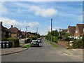
Allen Road, Haywards Heath
The southern part of the 'L' shaped road that provides access to Hanbury Stadium, Haywards Heath Town's football ground. This part was completed after 1947, see also Image
Image: © Simon Carey
Taken: 15 Aug 2015
0.04 miles
2
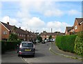
Boston Road, Haywards Heath
The residential road is shaped like a square and terminates either side of Image The houses were built in the late 1950s having previously been part of the plots given over to the cottages constructed by William Allen in the 1820s as part of the America settlement.
Image: © Simon Carey
Taken: 15 Aug 2015
0.04 miles
3
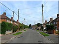
Allen Road, Haywards Heath
A residential road in the shape of an 'L' with this part leading to America Lane completed by 1947. See also Image
Image: © Simon Carey
Taken: 15 Aug 2015
0.04 miles
4
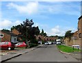
Jubilee Close, Haywards Heath
A cul de sac off Allen Road built in the early 1990s mostly in the former grounds of a house called Langridge.
Image: © Simon Carey
Taken: 15 Aug 2015
0.05 miles
5
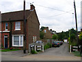
Langridge Lane
Small private lane off New England Road the houses being developed during the interwar period.
Image: © Simon Carey
Taken: 30 Aug 2007
0.06 miles
6
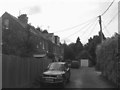
Langridge Lane, Haywards Heath
Small cul de sac off Western Road developed in the late 19th century initially as an access road to a house called Langridge which still stands to south amongst the trees. On the left are two sets of semi-detached cottages built in the first decade of the 20th century with Canadian Cottages on the immediate left and Quebec Cottages beyond. Between the wars, Adastra and Byways, another semi-detached pair were added beyond the hedge to the right. The garage straight ahead belongs to St Giles which was added in the 1960s, the last residence to built here.
Image: © Simon Carey
Taken: 15 Aug 2015
0.07 miles
7
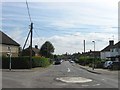
America Lane, Haywards Heath
Viewed from the mini roundabout which contains the junctions of Bentswood Road on the left and Western Road heading off behind the photographer to the right. For many centuries this roughly marked the parish boundary of Cuckfield and Lindfield with the later only absorbed by the growing Haywards Heath in the 1930s. The lane is named after a small settlement which was created in the 1820s by William Allen, a quaker industrialist and social reformer. The idea was to provide a small cottage with a large plot to chose agricultural labourers who wished to work and stay off the poor rates. The cottages lined the southern side of the road facing Bent's Wood, which then stretched north to Scrase Stream, with the plot, a thin strip attached to each cottage, stretching southwards to the parish boundary adjacent to Petland Wood. Allen's idea was to produce 'Colonies at home' in order to discourage emigration and encourage self sufficiency amongst the rural poor. Initially known as The Colony it was soon locally nicknamed America which stuck.
The settlement did well and remained in place up to the Second World War. In the 1930s this part of Lindfield parish had been transferred to Haywards Heath and with it the urbanisation that initially had stopped at this road junction, see http://www.britainfromabove.org.uk/image/epw039524?name=HAYWARDS%20HEATH&gazetteer=HAYWARDS%20HEATH&POPULATED_PLACE=HAYWARDS%20HEATH&COUNTY=West%20Sussex&ADMIN_AREA=Mid%20Sussex&ref=4 for an aerial view of 1932 with the cottages and their plots still in place. A decision was taken during the 1940s to demolish all the cottages which was carried out in 1944 and replace it with a new housing estate which was largely completed by 1950, see http://www.sussex.ac.uk/geography/researchprojects/sussexairphotos/1940/6-3055.jpg for an aerial view from 1947 with the cottages gone, the estate under construction along with the marked out new course of the lane, and the northern part of Image complete.
The lane itself originally ran eastwards then turned north up what is now Image then east again along what is now Image The new road which avoided these turns was built in the late 1940s and the eastern end reduced to a bridleway on the construction of Westlands Road in the early 1970s. In the distance are Image and Image
Image: © Simon Carey
Taken: 15 Aug 2015
0.07 miles
8
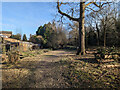
Haywards Heath Cemetery - Perimeter Nature Walk
A strip of land along the stream to the left is fenced off from the cemetery itself and contains the 'Perimeter Nature Walk'.
Image: © Robin Webster
Taken: 19 Feb 2023
0.07 miles
9
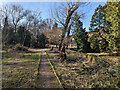
Haywards Heath Cemetery - Perimeter Nature Walk
A strip of land along a stream on the right is fenced off from the cemetery itself and contains the 'Perimeter Nature Walk'.
Image: © Robin Webster
Taken: 19 Feb 2023
0.07 miles
10
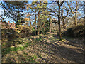
Haywards Heath Cemetery - Perimeter Nature Walk
A strip of land along a stream is fenced off from the cemetery itself to the right and contains the 'Perimeter Nature Walk'.
Image: © Robin Webster
Taken: 19 Feb 2023
0.07 miles