IMAGES TAKEN NEAR TO
Greenwood Drive, REDHILL, RH1 5PJ
Introduction
This page details the photographs taken nearby to Greenwood Drive, RH1 5PJ by members of the Geograph project.
The Geograph project started in 2005 with the aim of publishing, organising and preserving representative images for every square kilometre of Great Britain, Ireland and the Isle of Man.

There are currently over 7.5m images from over14,400 individuals and you can help contribute to the project by visiting https://www.geograph.org.uk
Image Map
Images are licensed for reuse under creativecommons.org/licenses/by-sa/2.0
Notes
- Clicking on the map will re-center to the selected point.
- The higher the marker number, the further away the image location is from the centre of the postcode.
Image Listing (9 Images Found)
Images are licensed for reuse under creativecommons.org/licenses/by-sa/2.0
Image
Details
Distance
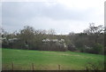
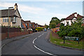
2
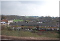
White Bushes, Redhill
Junction of Bushfield Drive (foreground) and Yeoman Way
Image: © Rib
Taken: 12 Jul 2006
0.13 miles
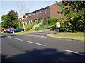
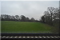
4
Houses at South Earlswood
On Prince Albert Square, seen from a train south of Earlswood station.
Image: © Derek Harper
Taken: 1 Oct 2015
0.18 miles
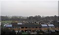
6
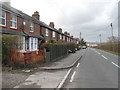
Cottages on Mason's Bridge Road, Whitebushes
Image: © David Howard
Taken: 29 Mar 2015
0.23 miles
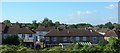
7
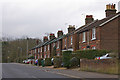
Mason's Bridge Road
A row of cottages on Mason's Bridge Road, in contrast to the 1970s Whitebushes estate that lies behind them.
Image: © Ian Capper
Taken: 6 Mar 2010
0.23 miles
9
Hillford Place
Part of the development of South Earlswood between the Horley Road and the railway that started in the late 1930s.
Image: © Ian Capper
Taken: 20 Jun 2012
0.25 miles