
IMAGES TAKEN NEAR TO
Limes Close, REDHILL, RH1 5GS
Introduction
This page details the photographs taken nearby to Limes Close, RH1 5GS by members of the Geograph project.
The Geograph project started in 2005 with the aim of publishing, organising and preserving representative images for every square kilometre of Great Britain, Ireland and the Isle of Man.

There are currently over 7.5m images from over14,400 individuals and you can help contribute to the project by visiting https://www.geograph.org.uk
Image Map
Images are licensed for reuse under creativecommons.org/licenses/by-sa/2.0
Notes
- Clicking on the map will re-center to the selected point.
- The higher the marker number, the further away the image location is from the centre of the postcode.
Image Listing (65 Images Found)
Images are licensed for reuse under creativecommons.org/licenses/by-sa/2.0
Image
Details
Distance
1
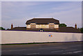
The Causeway
Built in 1997 on the site of the former Nag's Head pub, at the junction of Three Arch Road with the A23, the pub survived for less than 10 years, closing in 2006, with the site now awaiting redevelopment. The name "The Causeway" derived from the name of the company who funded its building (a poor investment, it seems!), rather than any geographical feature.
Image: © Ian Capper
Taken: 9 May 2008
0.01 miles
2
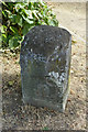
Roadside stone
A closer view of the west face of the stone seen in Image This side faces the A23, and seems to have traces of lettering on it. It is a mystery what this stone marked, but it is believed to be on the edge of the old extent of Earlswood Common.
Image: © Robin Webster
Taken: 16 Jul 2013
0.01 miles
3
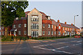
Warwick Gardens
New development on the site of the Causeway pub (see Image), at the junction of Three Arch Road with Horley Road.
Image: © Ian Capper
Taken: 9 Jul 2013
0.01 miles
5

Roadside stone
It is not clear what the purpose of this stone is (or was), situated at the junction of Three Arch Road with Horley Road (see Image - it is at the foot of the tree on the left of the photo). Whilst first impressions might be a milestone, it is not of the correct style (nor the correct position) for this road (see Image for one much less than a mile to the south).
The large scale OS map simply marks it as "Stone".
Image: © Ian Capper
Taken: 9 Jul 2013
0.02 miles
6
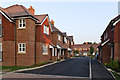
Warwick Gardens
New development on the site of the Causeway pub (see Image), at the junction of Three Arch Road with Horley Road.
Image: © Ian Capper
Taken: 9 Jul 2013
0.02 miles
7
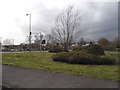
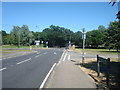
Three Arch Road at the junction of Horley Road
Image: © David Howard
Taken: 29 Mar 2015
0.02 miles
9
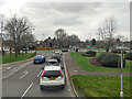
Junction of Three Arch Road with A23
In the Three Arch Road lane to turn right to head towards Redhill or to go straight over to Maple Road towards Reigate.
Image: © Robin Webster
Taken: 23 Mar 2019
0.02 miles
10
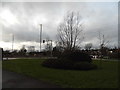
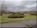
Island on Three Arch Road, Earlswood
Compare with previous effort http://www.geograph.org.uk/photo/4406587
Image: © David Howard
Taken: 31 Jan 2016
0.02 miles