
IMAGES TAKEN NEAR TO
Chanctonbury Road, BURGESS HILL, RH15 9EZ
Introduction
This page details the photographs taken nearby to Chanctonbury Road, RH15 9EZ by members of the Geograph project.
The Geograph project started in 2005 with the aim of publishing, organising and preserving representative images for every square kilometre of Great Britain, Ireland and the Isle of Man.

There are currently over 7.5m images from over14,400 individuals and you can help contribute to the project by visiting https://www.geograph.org.uk
Image Map
Images are licensed for reuse under creativecommons.org/licenses/by-sa/2.0
Notes
- Clicking on the map will re-center to the selected point.
- The higher the marker number, the further away the image location is from the centre of the postcode.
Image Listing (7 Images Found)
Images are licensed for reuse under creativecommons.org/licenses/by-sa/2.0
Image
Details
Distance
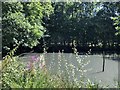
2
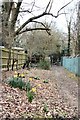
Green Lane
Approaching its junction with Sunset Lane
Image: © Peter Jeffery
Taken: 1 Mar 2007
0.14 miles
3
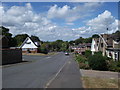
Oak Hall Park at the junction with Beechwoods.
Late 20th century housing in the south of Burgess Hill.
Image: © Curtis Bateman
Taken: 22 Jul 2010
0.16 miles
4
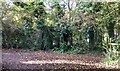
Path Junction
A junction of paths close to the railway line, which lies in a cutting just behind the fencing and tree cover.
Image: © Chris Thomas-Atkin
Taken: 5 Nov 2017
0.18 miles
5
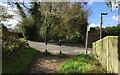
Oak Hall Park
Approaching Oak Hall Park on the Bridleway from the Keymer Road.
Image: © Chris Thomas-Atkin
Taken: 5 Nov 2017
0.20 miles
6
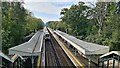
On track for Brighton
12 coach Class 700/1 Thameslink train from Cambridge leaves Burgess Hill
Image: © Chris Morgan
Taken: 10 Oct 2023
0.20 miles
7
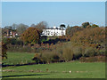
Franklands Court
This well-positioned house started out as Franklands and passed through similar names until the Franklands Court of today. It was also briefly called the Burgess Hill Hydro prior to the First World War.
Image: © Robin Webster
Taken: 26 Nov 2010
0.24 miles