IMAGES TAKEN NEAR TO
Church Road, BURGESS HILL, RH15 9BB

Introduction

This page details the photographs taken nearby to Church Road, RH15 9BB by members of the Geograph project.

The Geograph project started in 2005 with the aim of publishing, organising and preserving representative images for every square kilometre of Great Britain, Ireland and the Isle of Man.

There are currently over 7.5m images from over14,400 individuals and you can help contribute to the project by visiting https://www.geograph.org.uk

Image Map


Images are licensed for reuse under creativecommons.org/licenses/by-sa/2.0
Notes
  • Clicking on the map will re-center to the selected point.
  • The higher the marker number, the further away the image location is from the centre of the postcode.

Image Listing (194 Images Found)

Images are licensed for reuse under creativecommons.org/licenses/by-sa/2.0
  • ...
Image
Details
Distance
1
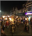
Bonfire Parade
The Burgess Hill Bonfire Society annual Torchlight Procession.
Image: © Chris Thomas-Atkin Taken: 23 Sep 2017
0.01 miles
2
Church Road
Looking towards the Station.
Image: © Peter Jeffery Taken: 27 Dec 1962
0.01 miles
3
Lloyds Bank, Burgess Hill
Image: © PAUL FARMER Taken: 12 Oct 2013
0.01 miles
4
Lloyds Bank, Burgess Hill
The building reflects history, seemingly first occupied by the Burgess Hill Constitutional Club about 1892. In 1906 Burgess Hill Girls School was founded here until it moved to its current location in 1928, see; https://burgesshillgirls.com/about-us/school-history/ Lloyds Bank's branch in Burgess Hill began as an office of the Hampshire Banking Co in 1875. That bank became the Capital and Counties Bank in 1878 and it merged with Lloyds Bank in 1918. Integration took many years with the two operating largely separately until 1934. New premises were being opened across the country as the bigger bank expanded and Burgess Hill branch prospered. Sad to see it is about to close for good, however a stay of execution seems to have been agreed to 17th September 2024, see; https://www.lloydsbank.com/assets/media/pdfs/branch-reviews/lloyds-burgess-hill-branch-part-1.pdf
Image: © Chris Morgan Taken: 10 Oct 2023
0.01 miles
5
Lloyds Bank no more
All closed up and seeking a new user
Image: © Chris Morgan Taken: 22 Oct 2024
0.02 miles
6
Where Redlands Once Stood
Looking across the vacant site where Redlands once stood to Church Road. The buildings to the left of the picture have now gone, as has Clifton Road from where this picture was taken. The buildings in the centre still stand, being Numbers 40 to 50 Church Road.
Image: © Peter Jeffery Taken: Unknown
0.02 miles
7
Redlands
A substantial house in Church Road, prior to its demolition to make way for shops.
Image: © Peter Jeffery Taken: Unknown
0.03 miles
8
Redlands During Demolition
A substantial property removed to make way for shops.
Image: © Peter Jeffery Taken: Unknown
0.03 miles
9
Christmas Snow
This is Church Road, Burgess Hill on 27th December 1962, After heavy snow fell on the evening of Boxing Day
Image: © Peter Jeffery Taken: 27 Dec 1962
0.03 miles
10
Market Place
Built in 1991 on part of the original site of The Martlets shopping centre that had opened in 1972 and an area that used to cover a large open air market, hence the name.
Image: © Simon Carey Taken: 2 Mar 2008
0.04 miles
  • ...